A stroll through the beautiful peak district countryside from Bakewell, taking in the stunning Lathkill Dale and a section of the Limestone way
Bakewell to Chatsworth House loop - June 2022
Calke Abbey walk - May 2022
River dove Ashbourne tissington trail - January 2022
Downloads: GPX File | KML File | FIT File | Google Maps File | OS Online route
About River Dove | About Tissington Trail
Parking Location | OS Map | Current Weather
We started this route by heading into Thorpe and connecting briefly with the Limestone Way, before heading past the church and walking until a small path was found just over a stile to our left. This passes over a wide grassy field full of sheep. Here, there were great views of the hills and valleys both in front, and to the sides with a valley that the river Dove had carved away.
Reaching the bottom and over another stile, we headed into a small wood. This is where the path became very muddy. We had to take our time not to slip down the steep hill. After leaving more than a couple of large slip marks in the mud, we crossed a small wooden bridge, and the river Dove came fully into sight in front of us.
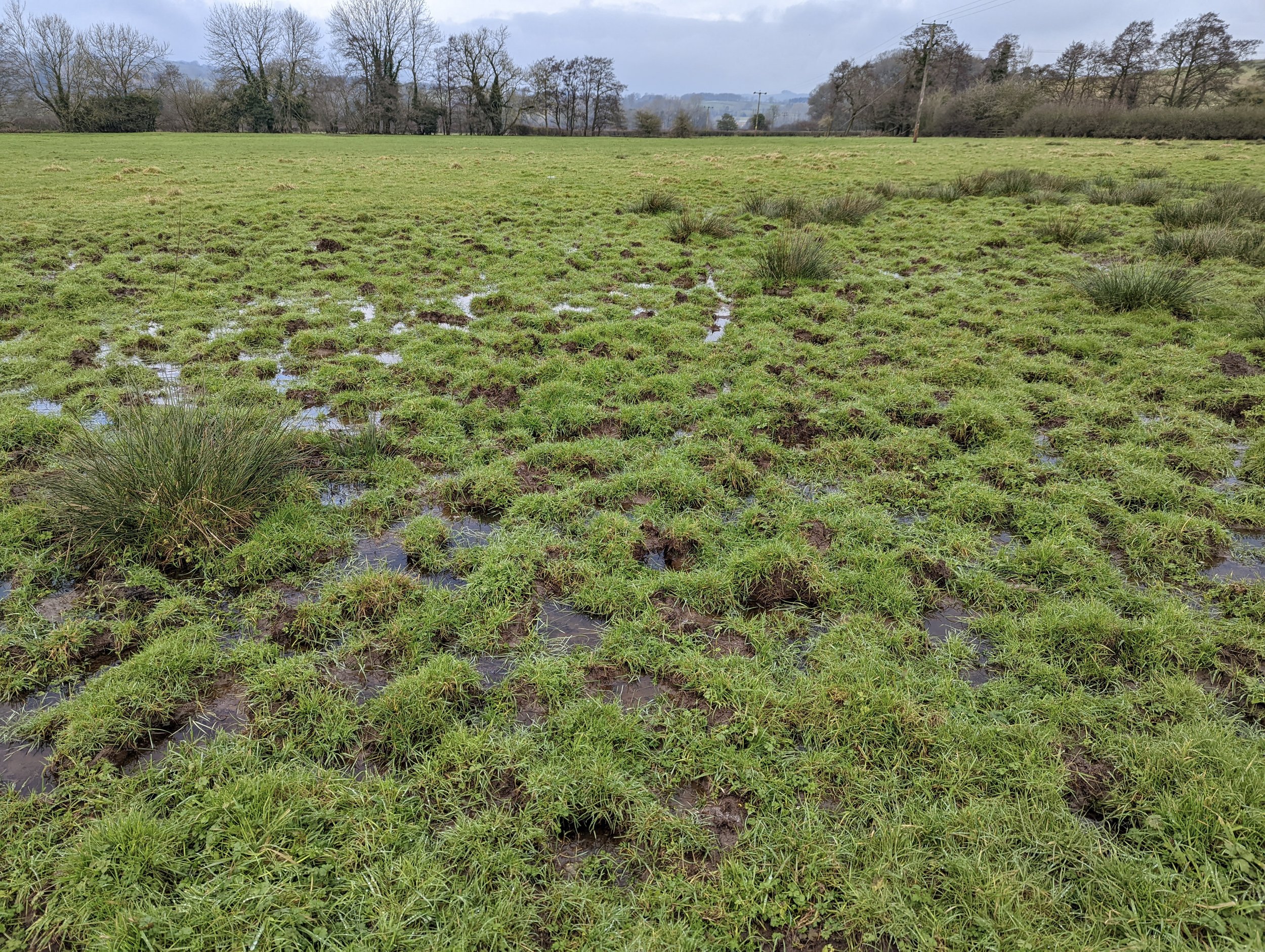
Taking the T junction left, heading over a stile, we found that the incredibly muddy hill was just the start! We had to cross a section of mud that was probably 3-4 inches deep with no real way around (check out the photos if you want to see just how muddy we got!) Once we had trudged our way over the mud patch and tried to clean up on the grass a little, the route became a little firmer.
The path follows alongside the river and is easy to follow without too much change in elevation. Mud continued to be a theme, but I suppose that’s what you get for walking the Peak District in a wet January. We carried on taking this path all the way to some wider fields where we skirted past Mapleton, before swinging back towards the river ...and back onto some muddier paths. Eventually the mud started take its toll and our pace suffered. At least we managed to stay up right! But luckily, things improved not too much further along, as the path made its way around the edge of a farmer's field. The ground here was much more stable and there was plenty to look at as a few birds of prey could be seen flying over the edge of the meadow.
The path begins to head off over Bentley Brook, at which point you can choose to carry following the river Dove to the right, or head left as we did and head towards Ashbourne. The path here is on a bankat the top of a sloping field, this made an awkward traverse, but at least it wasn’t muddy! Towards the end of the field, a small path appears to the right. This takes you directly into the heart of Ashbourne (a beautiful town if you’ve never been!) we followed the main steps down towards St Oswald's Church before swinging into the centre of town. After contemplating grabbing a coffee and cake, we realised that nobody in their right mind would allow our quite unbelievable muddy boots and knees in (no matter what the sign said), we decided to carry on into the heart of the town.
After a little picnic, we made our way to the main carpark and the start of the Tissington Trail. This is the magic part! We lumbered through the 350m brick lined historic train tunnel that runs under houses and roads of Ashbourne. It was surreal, and although not the normal natural view we love, it’s simply stunning. Definitely an experience to tick off if you are in the area. Once through this amazing landmark, the Tissington trail starts up proper. You quickly head down a small hill and over the river again, before the land heads back up. Expect lots of walkers and cyclists here, even in the cooler months. As you can imagine, being a disused railway, it’s flat and very quick. In fact, this whole section of the walk took about half the amount of time than the first and we didn’t even rush. There are some spots of views out, but most of the way you follow the wood lined path under and over tunnels before arriving back at an old train station where we leave the trail and back up to the car.
If you're considering this route, please do you’ll love it! However, I'd definitely recommend doing it in the drier months of the year to avoid the mud bath. Even then, take some gaiters!
Pike Low, Lost Lad, Back Tor, Dovestone Tor, Derwent Edge, White Tor and Whinstone Lee Tor - August 2020
Baslow Edge, Eagle Stone, Curbar Edge and Hay wood circular
Stannage Edge Loop - July 2020
Manifold Way - July 2020
Cats Tor, Shining Tor and Errwood Hall - July 2020
Deep Hayes County Park and Canal Route - June 2020
The Roaches to Tittesworth Reservoir - December 2019
Download GPX File | Google Maps File | OS Online route
About The Roaches | About Tittersworth Reservoir
Parking Location | OS Map | Current Weather
This walk was done on a sunny but cold winter’s day. We were trying out some new gear for the first time, so we wanted a shorter walk to test things out. We had previously deliberated as to whether it would be nice to walk between The Roaches and Tittesworth reservoir, so we thought now would be the perfect time to find out. The conditions higher up were putting us off going over The Roaches and we had the water of the reservoir beckoning us from our vantage point at the roadside, where we parked our car.
We parked on Roach Road, there is a lot of space along the side of the road and a local farmer normally opens his field for a small parking fee. Although, it can get busy on nice weekend days. We suggest getting here early and to never park in places where not designated to do so. Just recently, emergency services were unable to get through due to inconsiderate parkers. Besides, the parkies WILL ticket you. We see so many yellow tickets on people’s windscreens every time we come!
The Roaches and Ramshaw Rocks area is our stomping ground. For us, it’s the closest part of the Peak District and by far, the easiest to get to. We walk here every few weeks, but if you haven’t been before, we would recommend walking the length of The Roaches before descending onto the reservoir. On the other hand, if you want a countryside walk with no steep inclines, lots of fields and wildlife, this walk is the one for you.
Even though we were expecting mud, being the middle of a wet December, we found the first leg of this journey a lot muddier than we would have liked. However, after the initial mud bath, the going got better and we were pleasantly surprised at how little bog there was thereon after.
We started off walking around the back of Hen Cloud, the rocky outcrop on the end (start?) of The Roaches. From here, the path cut down to the river. This is where there was mud and a lot of it. We can imagine there still being mud swamps here in the summer, so be careful and wear appropriate boots. We nearly backtracked to walk up and down Hen Cloud itself to escape the swathes of sludge, but we were so glad we persevered! The stretch after was glorious. A beautiful stream, canopied with a plethora of tree species, leading to a few old, abandoned buildings - one holding an old water wheel. The dirt path turned into a stony path which slowly evolved into a county road, it was a very tranquil and quiet area to walk.
Not too much longer and we were out onto the Roach road again but a lot further down. Here, we turned right. After a quick wrong direction (taking a left two early) we turned left, the right one this time! Then made our way down Whitty Lane. At the end of Whitty Lane, we took a left turn onto Blackshaw lane for about 200 yards and then crossed over, before the bridge, to take a right turn onto a footpath. This path was slightly busier but was lined with a hedgerow absolutely full of Robins. The close proximity to the River Churnet had us spotting creatures we just weren’t expecting this late in the year. This path led us onto the round route of Tittesworth reservoir itself.
Exiting the reservoir via the main entrance, we took a left onto Blackshaw lane then took the right where the Lazy Trout pub is. We carried on up this road then turned right up towards and past some houses. The footpath does run through a few fields where a nearby house is keeping horses. However, the way is clearly marked, and it wasn’t long before we were traversing field after field. We eventually found ourselves on a long, stony track leading to a house but the footpath does cutaway into the overgrowth before you get to the residence. From here, we travelled through some reedy fields with convenient boardwalks before starting to slowly incline towards the Roaches. Considering it was winter, we saw a lot of wildlife here including a heron in flight. We are planning another walk going through the same territory for a summer walk also. We are expecting it to be teeming with birds and creatures.
Walking up a farmer’s track and through a quiet farmyard, we stopped to admire a beautiful well with a natural fountain before having a quick steep stomp back onto the Roach Road and back to the car.


