Downloads: GPX File | KML File | Google Maps File | OS Online route
About Lost Lad | About Dovestone Tor | About Derwent Edge | About White Tor
Parking Location | OS Map | Current Weather
This walk will give you great views of Howden Reservoir and Derwent Dam. you get height with a fresh ridge walk and a lovely reservoir walk on the way back. This is a good all rounder and a popular route.
Starting at Fairholmes car park, we made our way to the base of Derwent Dam to take in its magnificence. Following the road round through trees. Then taking the left turn to follow the road north and up. We walked while keeping an eye out to our right for the opening in the dry stone wall.

The walk soon becomes steep but still grassy as it takes you through the wall. With trees on our left we ascend up and into another copse. Here, the way turns into a proper path and we follow this into, and out of, another small wood. As we emerged from the shade here, we found ourselves on a gorgeous old stoney path, lined with bilberry bushes and long grassy vegetation. Wild flowers were sprouting from clumps in the centre of the path and we started gaining height while hugging the side of the hill. There are great views out as we look South-East over the length of Ladybower reservoir. As it levels out, we head north over grassy fields where the heather had just started to bloom into a patchwork of green and lavender colours. With some stunning views behind, we reluctantly turned our backs and headed to Pike Low.
Walking over moorland and sheep country, our path became a crossroads of sorts. We turned right, through a gate here and followed this North-East. Then north as we reached a fence. The route slowly swung us round to the base of Lost Lad where we joined a wider, well maintained path. We climbed up some beautiful stone steps to Lost Lad Hillend and then Lost Lad itself.
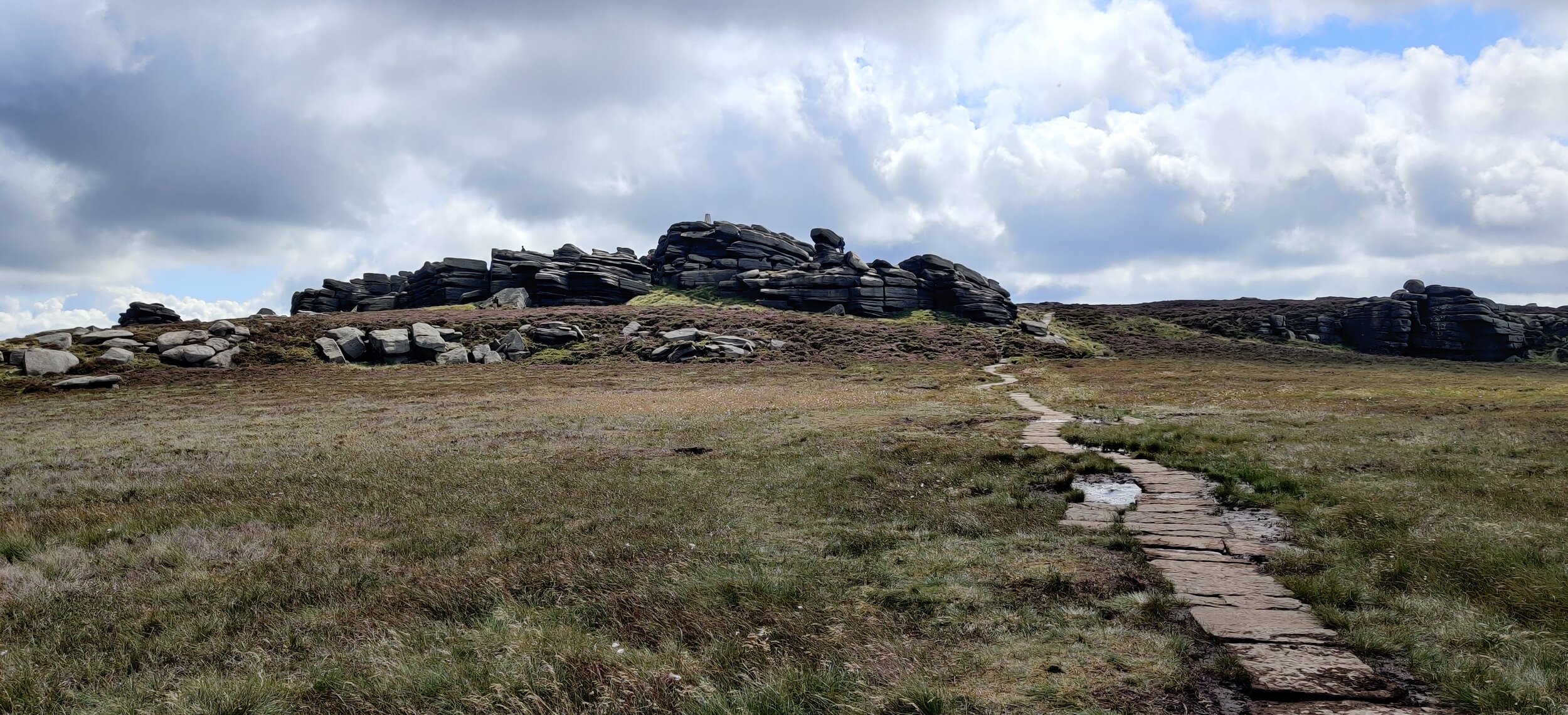
From here, we carried on the stone slabbed path to the highest point, Back Tor. An unusual but interesting rocky protrusion of gritstone rock. On top of the highest point is a white trig point and many people scoot up and jump across crevices to reach it.
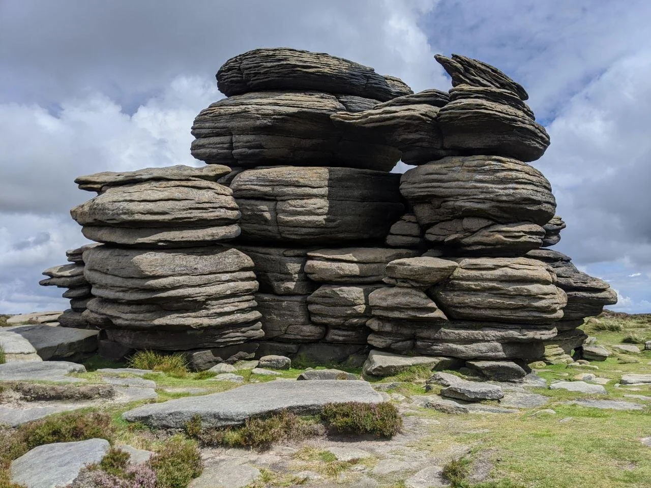
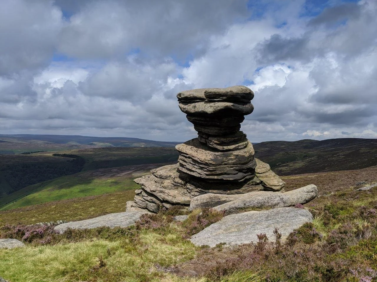
As you travel on, you walk past more rock formations, coming here late July/August is best. The grey rocks almost spring out of the flowering purple heather. The greens of the hills and the sapphire water in the distance below gives you an entire palette of colour to feast your eyes on. We went on to reach; Cakes of Bread, the Dovestone Tor, and the Salt Cellar (my personal favourite). You are able to take a detour off the path and walk right down to the Salt Cellar. This is where we decided to have our lunch. There are many smaller and interesting formations in between the large ones so it never feels too ‘samey’ as you’re walking. As soon as we got past the Coach and Horses formation, we run out of rocks to look at. We spent the rest of the walk along the ridge looking for mountain hare, red grouse and birds of prey.
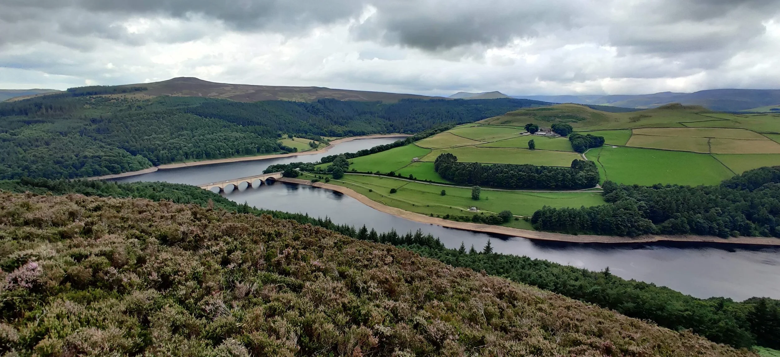
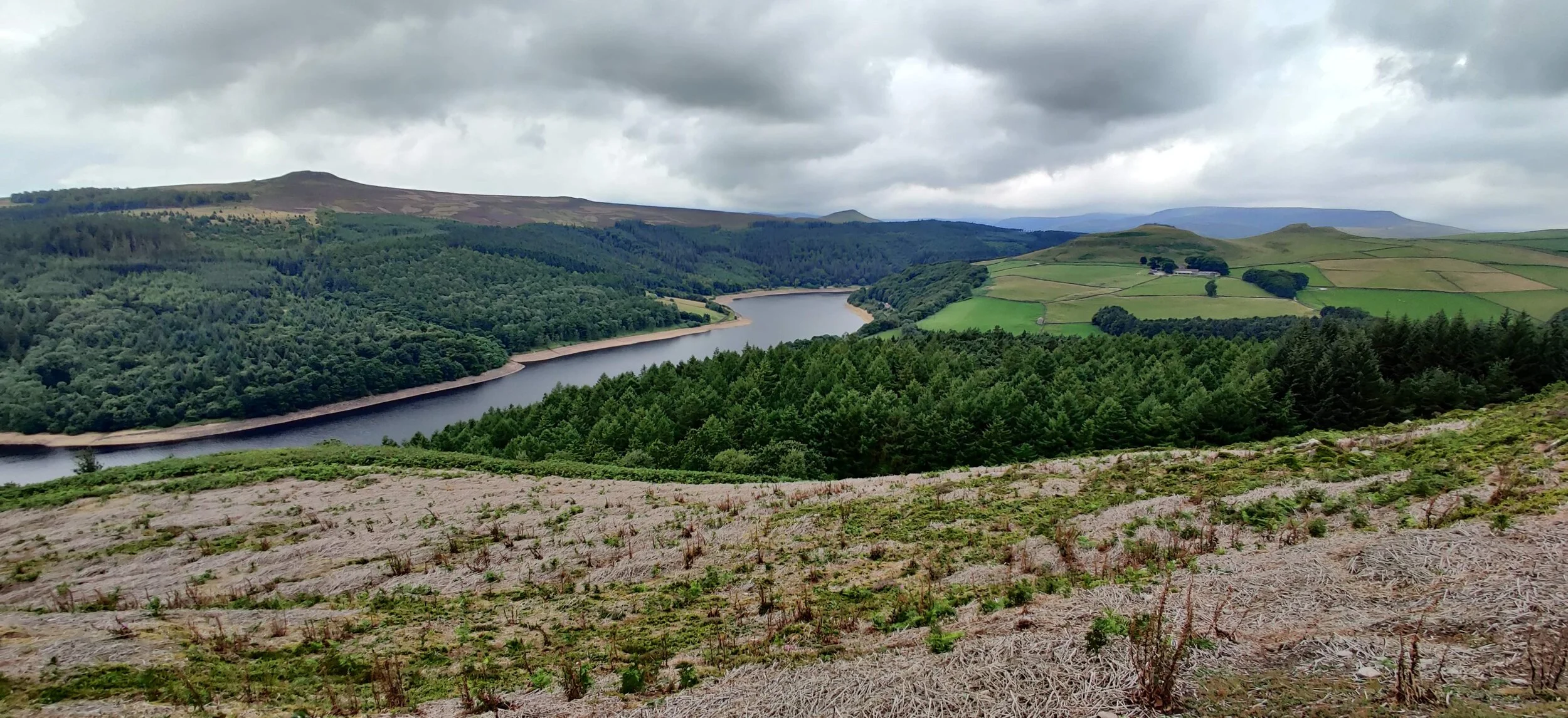
We eventually got to a point where 5 paths meet. Just beyond is a great viewing point. Proving quite popular as from here, you have great views of Ashopton Viaduct. A very photogenic bridge, where the Snake Road (A57) crosses Ladybower reservoir. The full length of the Derwent is also visible.
At this point, if you are now wanting to make your way back to the reservoir, take the right path heading West, down off Derwent Edge. We wanted a longer walk so we carried on round the ridge. You can take a detour left to the Hurkling Stones here too. The path here is narrower and you are exposed to a drop on your right side, but does widen back out. As you reach the end of Derwent Edge, you make your way down with views in front of the A57 below. We veered more to the right and used small paths, carved into the waist high ferns and vegetation. Finally coming out through a gate and onto a small road in Ashopton. We followed this down, passed a few houses and turned left onto the reservoir path. From here, it’s a long but easy and flat walk up to Derwent Dam and back to the car park.