Downloads: GPX File | KML File | FIT File | Google Maps File | OS Online route
About Lathkill Dale | About Limestone Way
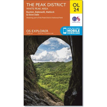
Parking Location | OS Map | Current Weather
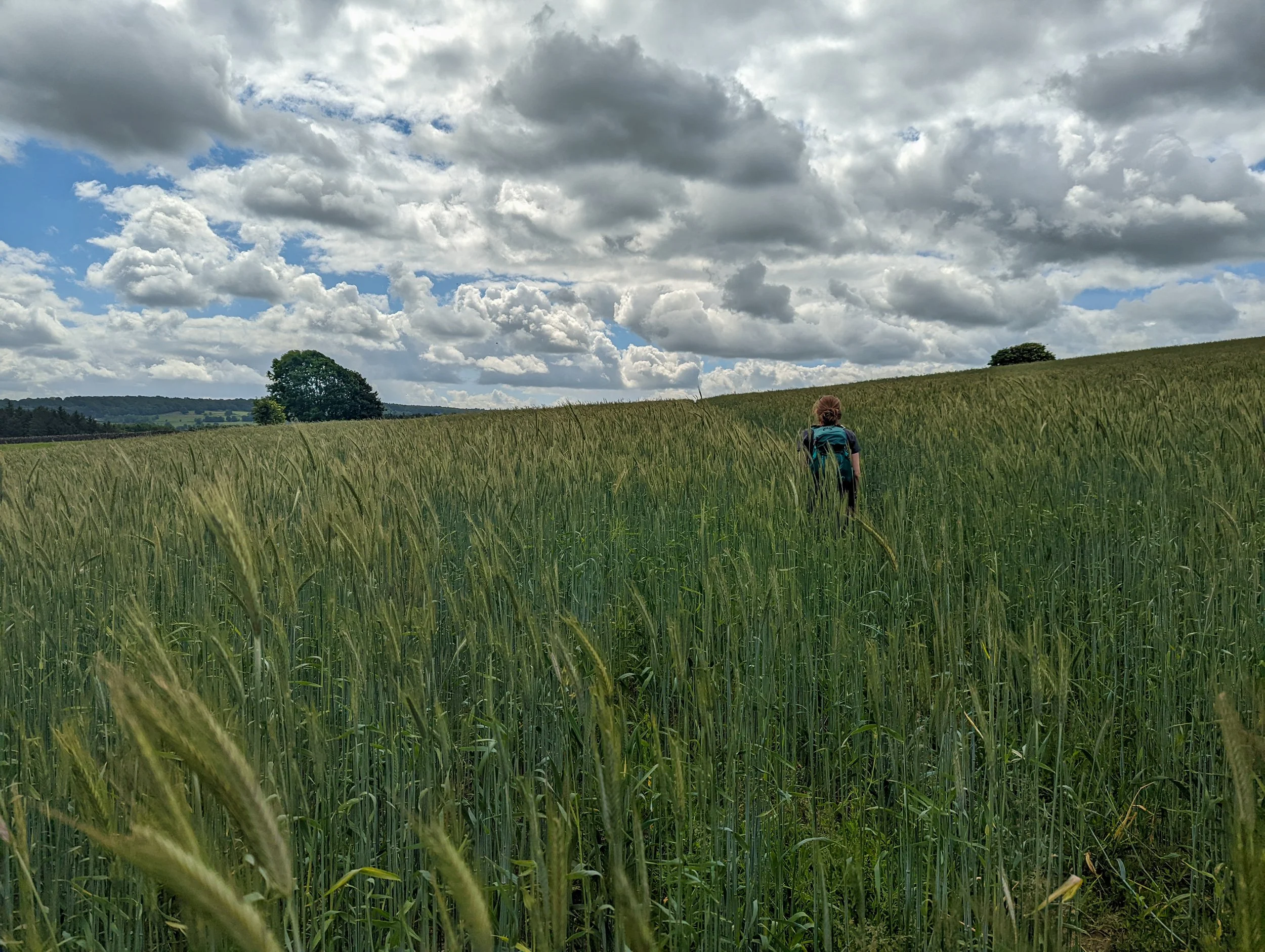
Starting out in Bakewell, we travelled for a brief time along Haddon Road before turning on Intake Lane. At the end of here, we followed a path to the left. This leads us off into Burton Ashes Wood. Once through this short woodland where we followed the obvious path, the route dips down into a valley then rises back up the other side, just past Wigger Dale. Once through into the next field, we managed to gain some height and were treated to a view of the rolling hills to the side of us. These views were soon snatched away however, as the path opened into a field of head high wheat like crops. The wheat was almost head height in places, and the path dissected the middle of the field. All we saw was the narrow path forward and behind, everything else was green, golden grasses. It was like no other path we have

After making our way through a couple more of these wheat fields, these were quite a bit shorter than the first, we ended up on more usual ground. A large field with a little trodden pathway. We followed this until we reached the wall, here we took a right-hand turn. The following two fields did contain cows, which as cows like to do, were all stood on the main path. They offered no issues however, and we gave them space as we made our way through and once out of the fields, we headed off to our right.
This is where we started a descent and once over the road headed through another, smaller field of wheat. Then joining up with a path at the end, we took a left turn and started the final descent towards Lathkill Dale. A short spell on the road gets you to the entrance where you are greeted by a sign and a small map.
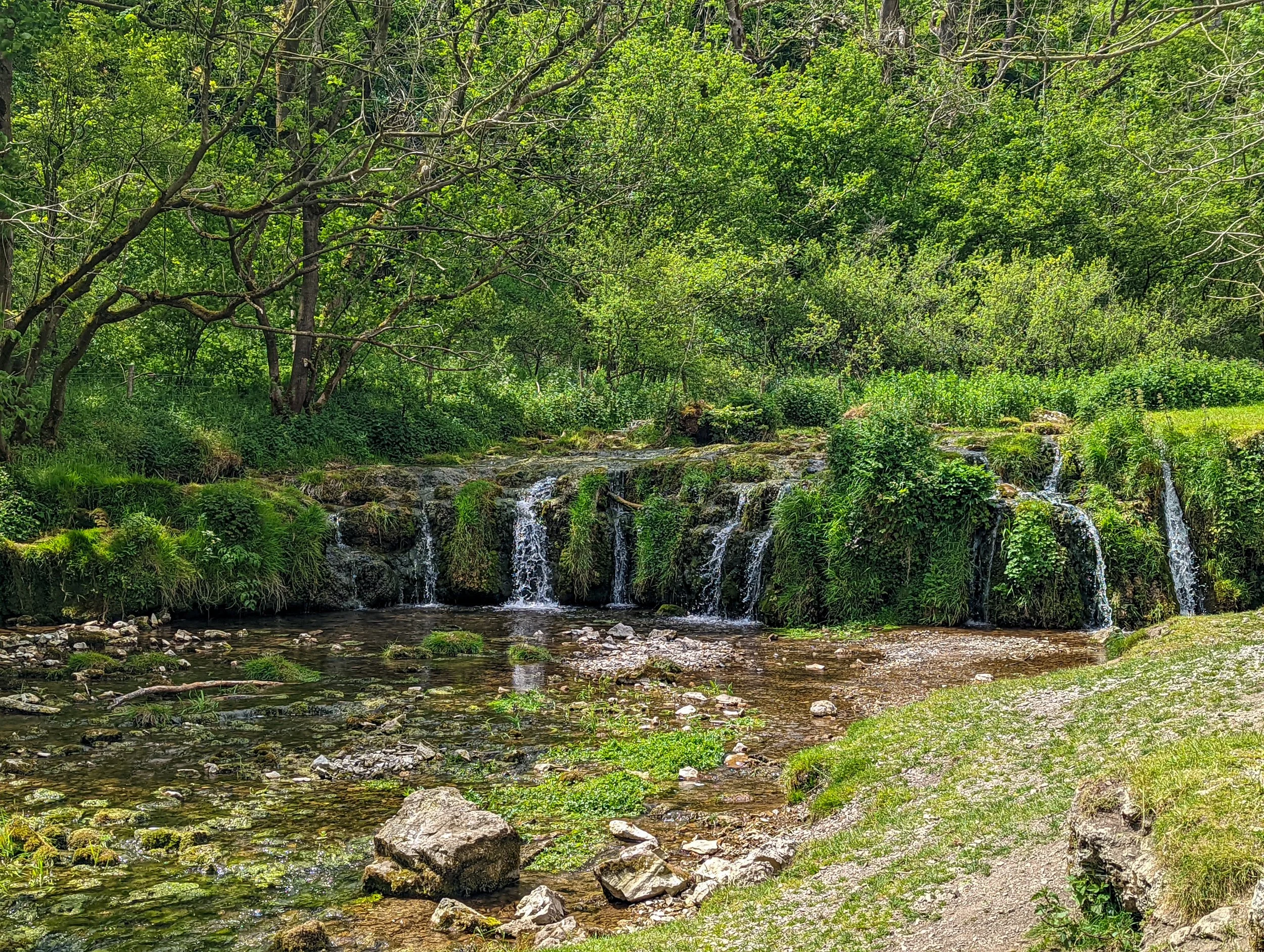
Once entering Lathkill dale, the path was quite wide and as we had entered the summer months, there was a lot of greenery. Both sides of the valley were covered in plants, flowers and all the trees were at their peak. We followed the river, coming across some beautiful spots where the water was tumbling down rock faces and small pools were filled with wildlife. Continuing along, the path was getting smaller and smaller (thanks to the abundance of plant life encroaching on the path). But it was also getting busier. This part is an immensely popular tourist destination so eventually, we became part of a conglomeration of walkers, collected together as the narrow footpath meant stepping into the overgrowth to give way to oncoming wayfarers. Enjoyable as it was, this kind of thing cements our preference of off season walks over peak times!
This was starting to get a little frustrating as we are used to having entire mountains to ourselves, but once we passed below Over Haddon, we found less people on the trail. I assume, that the people enjoying the beautiful deep pools and wildlife were less concerned about following the path all the way along the river, but whatever the reason, we soon managed to get some pace up.
The rest of the walk along the valley is a lot like many of the other peak district valleys, which is to say, you follow a lovely winding river on a good, stoney path surrounding by lots of trees. It is great, and on such a sunny day, we were happy for the shelter for the trees. You do loose the river at points, other times the path gets close, and it does make for an interesting walk.
Eventually, as we neared the end of the river Lathkill, we headed over a bridge and up through woodland. This path was a bit smaller and more of a dirt path, but eventually it brings you to a crossroad where this path continues, and the Limestone way dissects it. We took the Limestone way to the left, then headed up about one million steps. Again, we crossed a large group of walkers, and because it was on the steps it was a little more difficult. Once to the top, we headed out of the woods and into some open fields.
You get a beautiful view back towards Lathkill Dale at this point and can really see where the water has carved its way through the landscape. We kept on walking along the limestone way and through a grassy field before moving through a small wood. Following on from here, the path swept through a much bigger field that had a few birds of prey hovering, possibly due to the farmer recently cutting down the grass. On the other side of the field, we entered another small holding with around five or six cows in, but they were tucked up in a corner, so we continued along the path.
Coming out on to the road for a short spell, where only one car passed us while going slow, we turned off and made our way through some more fields, slowly making our way downhill. At the end of this path, you do reach another a road, but once again it is for a very short spell and there is room at the side if a car were to come. A small path over the wall through Sidenooks plantations follows the Limestone way, and then you exit onto Weddow Lane. Luckily, there is a path along the side of the road. You still have a bit of height here, so some of the views out are great, and as there is a pavement, you can make your way quickly along here.
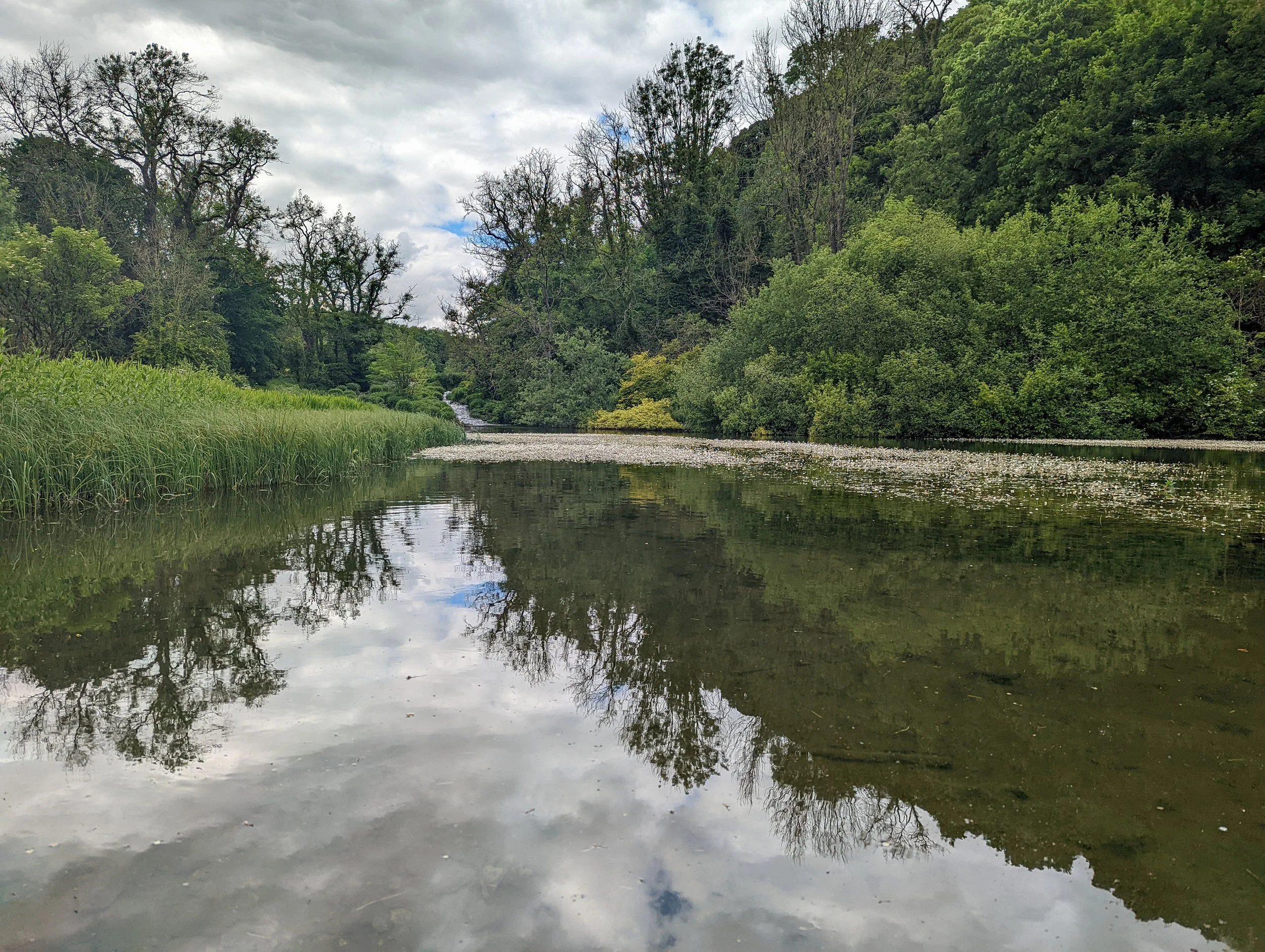
Eventually, there is a path off to the left down to the river Bradford and this continues to follow the Limestone way. We zig zagged our way down and once at the bottom, crossed the bridge and followed the path to the left. This follows the river for some way and, in my opinion, a much more beautiful valley than Lathkill Dale. There are 3-4 ponds that the river flows through, each one filled with baby ducks. The riverbanks also had several varieties birds looking for lunch. The path is less overgrown too, so not only is the walking easier, but you get a much better view down to the river.
Following the Limestone way below Youlgreave, and we passed over Hollywell Lane, this continues to follow the river, but also passes another much wider section. This has been converted into a wild swim area. We saw a small group of people enjoying the summer day in the river. It just looked like bliss.
At the end of this path, we took the route left, up the small road then followed the public path between the houses. At the end of here, we another road for a short distance before turning right along a path which runs parallel to the river Bradford. While being much higher, as you can imagine there are a few impressive views here. This path sweeps through a few more fields and before we knew it, we were at the next village of Alport.
Following the path to the left, we once again picked up the River Lathkill and followed for a while. Like most of the walk this is grassy paths through fields, and these ones weren't too interesting, so we managed to stretch our legs a bit. Once at Coalpit Lane, we took a right turn over the bridge. There is a beautiful section of the river here where the river turns into a pond, it is very serene.
The walk up from here through the woodland is diverted, there isn’t a path where both open Street or OS maps advise and there seemingly never has been! However, the actual path is not only sign posted, but clear. This footpath took us back up towards the big field where first we came across cows. Luckily, they had shifted a bit, so we were able to just follow the path uncontested and we did so all the way to Haddon Road.
Upon reaching Haddon Road, we walked on the pavement at the side of the road. We soon got bored and decided the path on the map following the river Wye would be a much nicer experience. Now, there wasn’t any cars, so that was a bonus. However, the fact that for 90% of the route, we could hardly see the floor due to how many weeds had overgrown the sides of the path made it a frustrating experience. There are sections that were beautiful, following the meandering river along without a soul in sight, but we spent far too long just getting through the weeds. As we came out of this path, and crossed the road, we came to a path we had walked the previous day, so we knew was much better for walking. Additionally, it led back to the centre of Bakewell, which is where we wanted to finish, so we carried on along here.
It is an easy path to follow, and before you know it, you can see Bakewell edging closer. The path makes its way to the main car park. We followed the route to here before switching off our tracking. We then went on the search for an ice cream van. After devouring a 99 with flake and raspberry sauce, we grabbed a chippy and sat on the riverbank in the beating sun.
It is delightful having a walk end in such a fantastic place as Bakewell, you can enjoy the amenities, grab some food, or drink and just enjoy yourself. But the walk was enjoyable too. The two main valleys were both beautiful and there was some good walking involved, it was a big day though at 23km, so a portion of fish and chips are very much deserved!