A stroll through the beautiful peak district countryside from Bakewell, taking in the stunning Lathkill Dale and a section of the Limestone way

A tour of the perfect British countryside between Bakewell and Chatsworth house
Direct route to Ben Lomond from the base at Loch Lomond. This high route takes you to the tallest peak in the national park with stunning panoramic views at the summit.
An Epic round route taking in the three wonderful peaks of Dollywagon Pike, Nethermost Pike, and Helvellyn. One of the best walks we have done with amazing views in every direction and some really varied terrain.
A fantastic walk starting in Grasmere, before heading up to Easedale Tarn. From there the four central wainwrights of Blea Rigg, Sergeant Man, High Raise, and Tarn Crag. An amazing round route with excellent views as far as Skiddaw and Derwent, Blencathra, and even Helvellyn.
Downloads: GPX File | KML File | FIT File | Google Maps File | OS Online route
About Alltwen | About Penmmaen Bach | About Conwy Mountain
Parking Location | OS Map | Current Weather
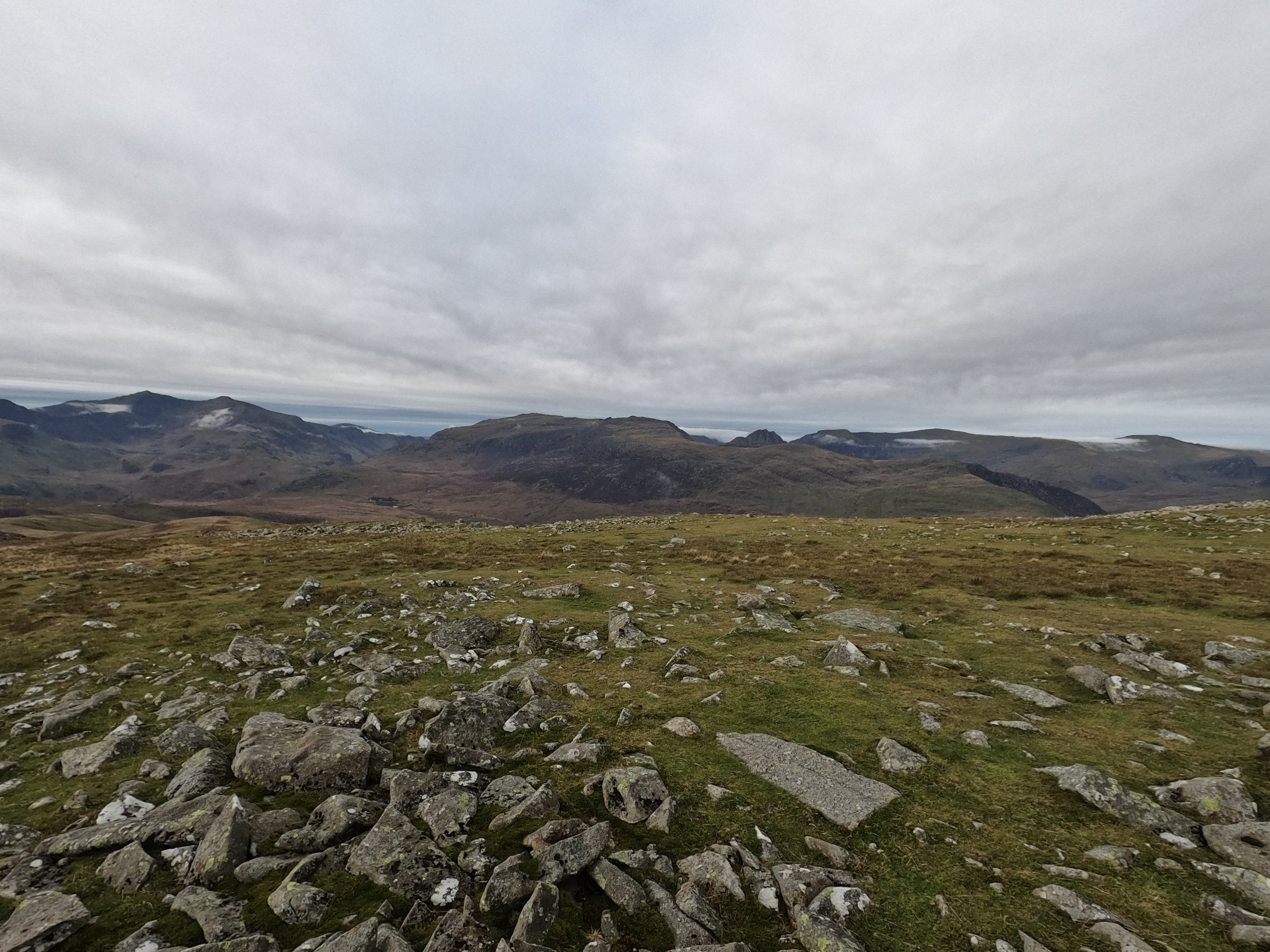
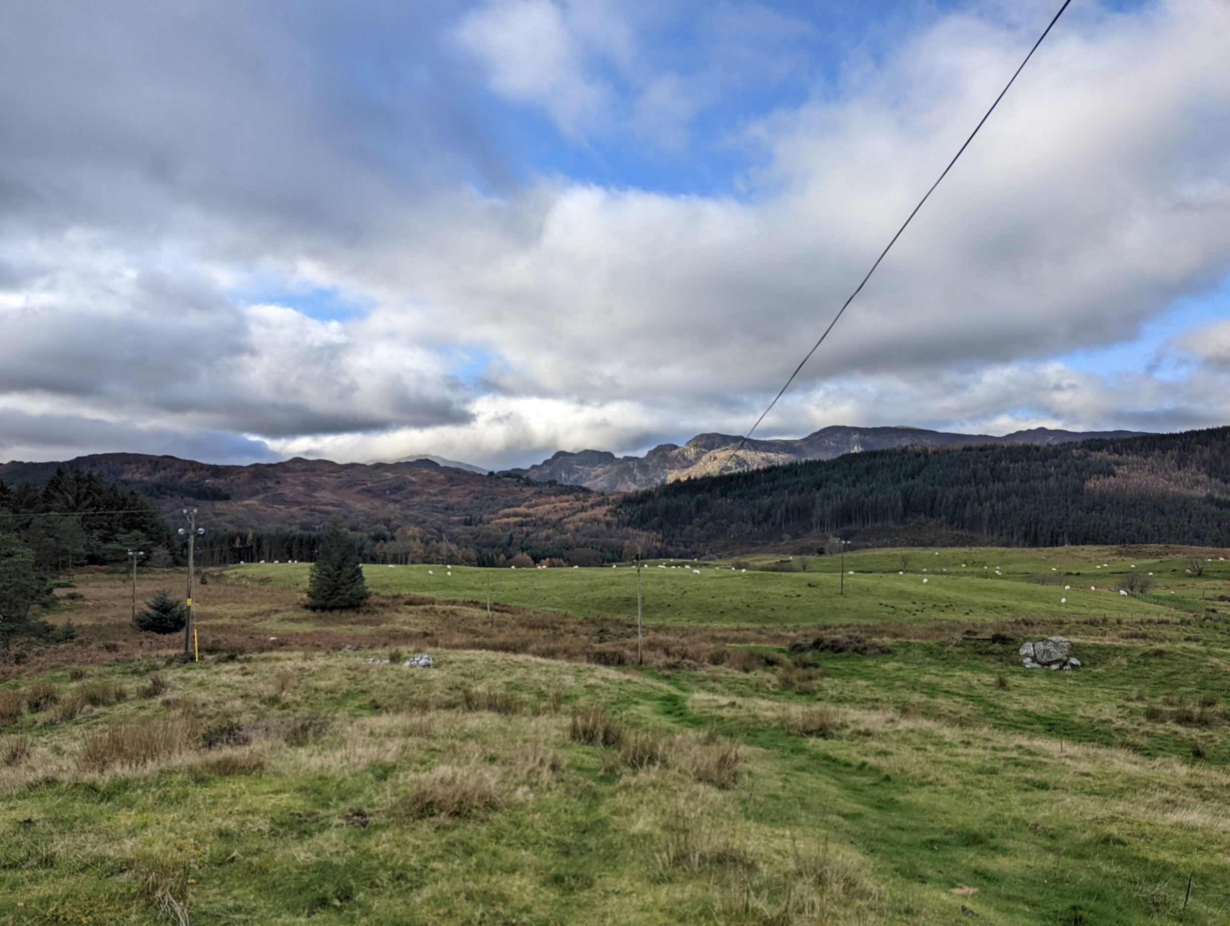
We only wanted a small walk for our first day back in Snowdonia, but wanted to get some height in. We had plotted a route taking in the three small peaks just outside of Conwy. After the few hours travel, we were parked up and on our way by late morning.

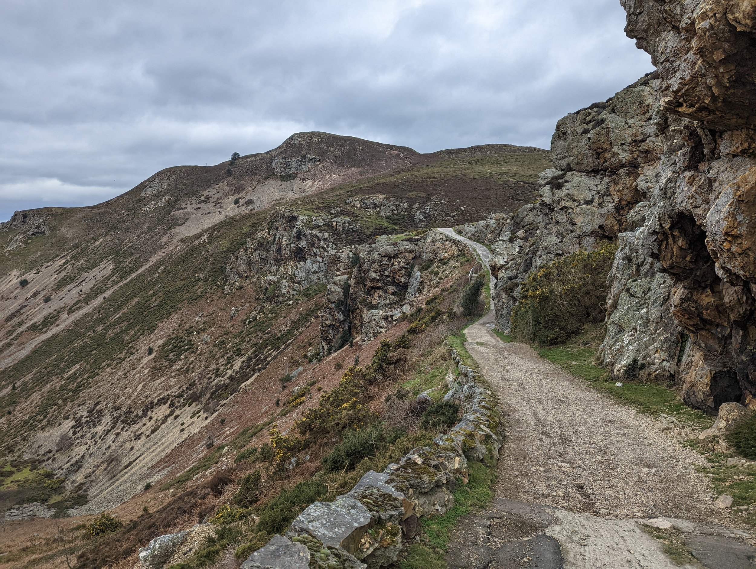
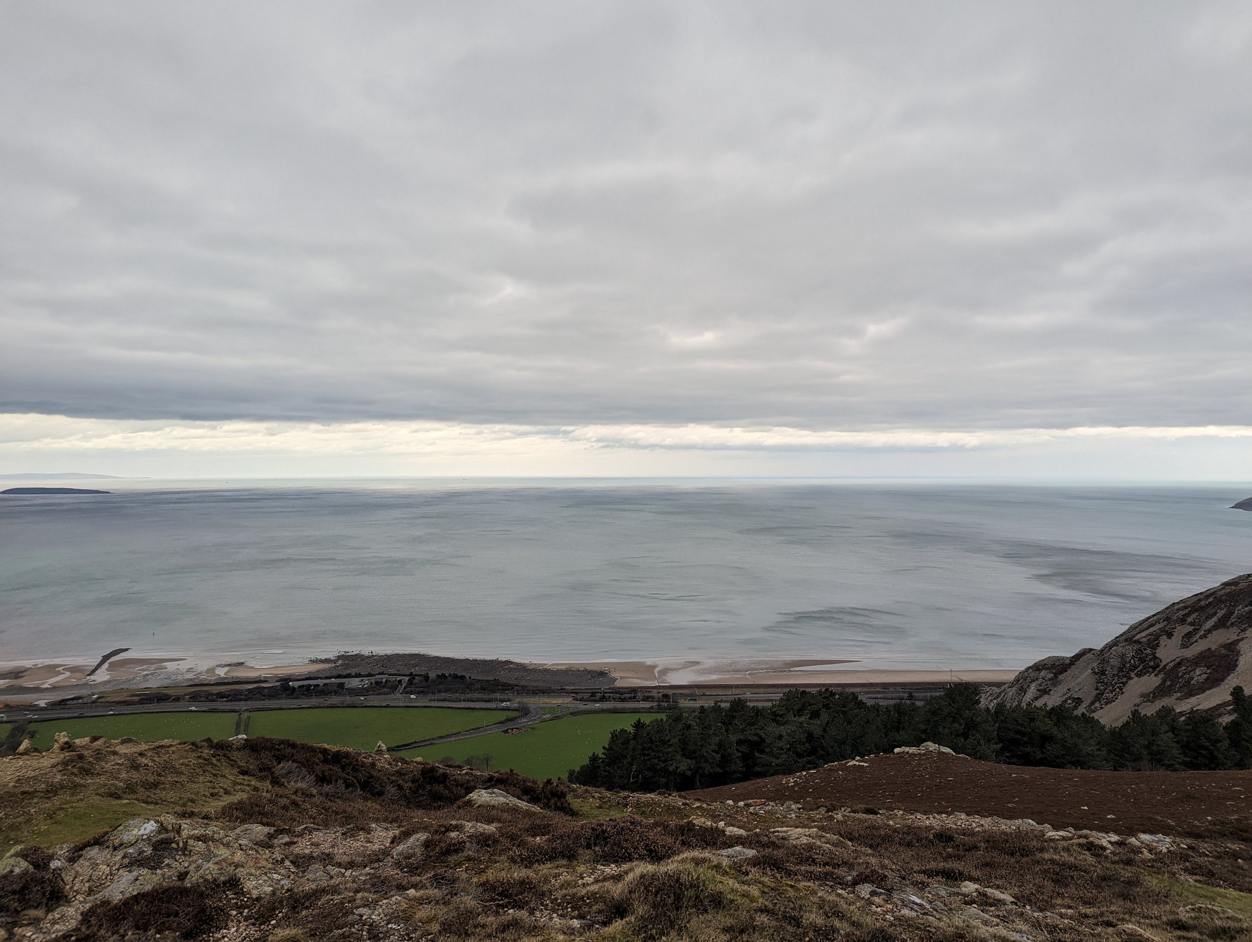
The start of the walk follows a small ridge. It is technically a farmer's path which is more than wide enough for walkers, but I wouldn’t want to drive a long it! Once over, the actual path heads up on the left and starts the climb to the first small peak. It is easy going and there is a couple of obvious routes to the top to choose from. Once at the peak of Alltwen, you are greeted by some amazing views for the effort. The beautiful beach and sea stretching out over the horizon with the endless mountains spanning out behind you is a calming and revitalising sight.
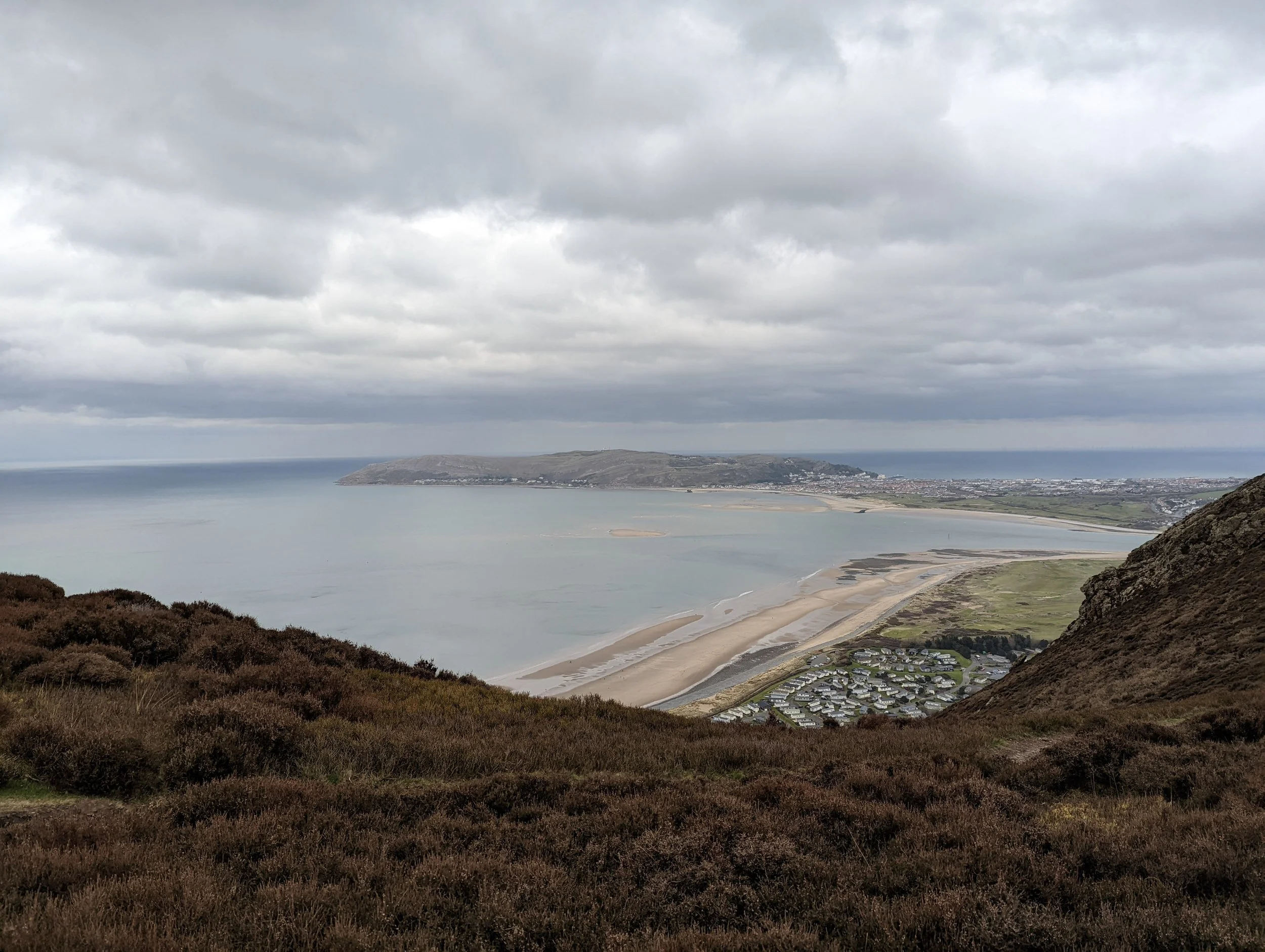
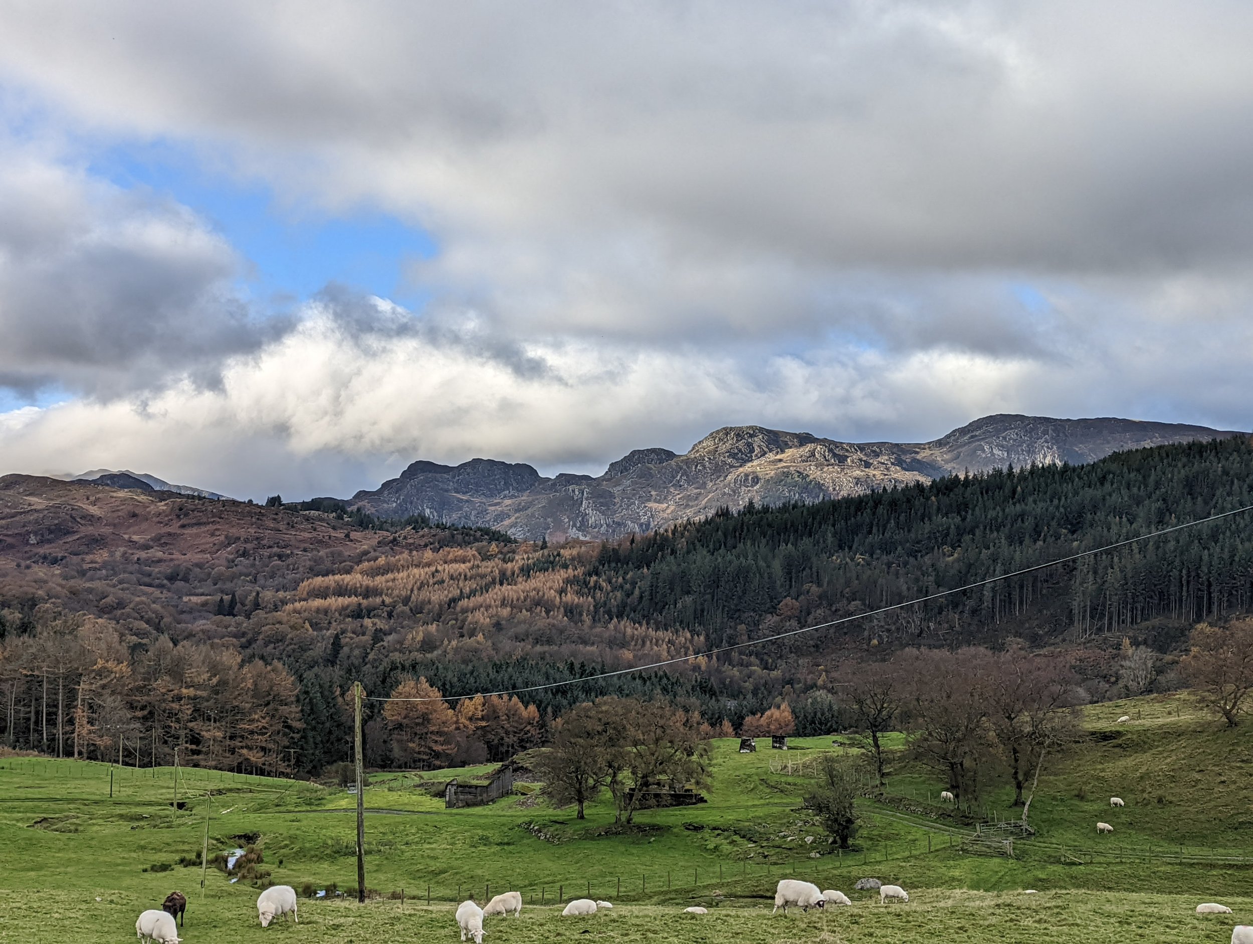
From here we made a sharp turn towards our next peak, Penmmaen Bach. The walk down between the two is a little rough, and not often trodden so you must take a little care. Although it is clear enough and once past the steepest initial sections, it softens out until it’s almost flat. We came to a small boulder field, here we found a place to sit and have a bit of lunch while looking out to the sea and getting some of that fresh “sea air”. After this, we started the steady climb to the next peak, heading into the hill, then thrusting out towards the sea before reaching the top. Very similar views to the first peak, but with a little more of the Great Orme on show.
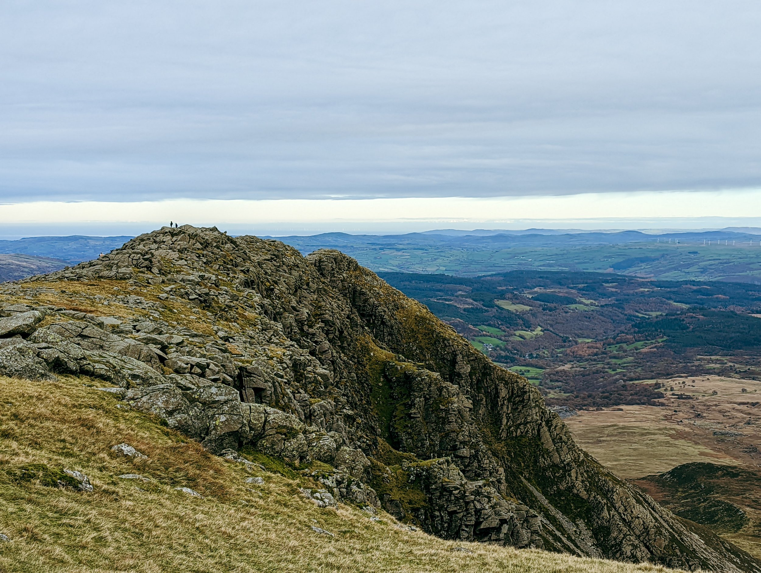
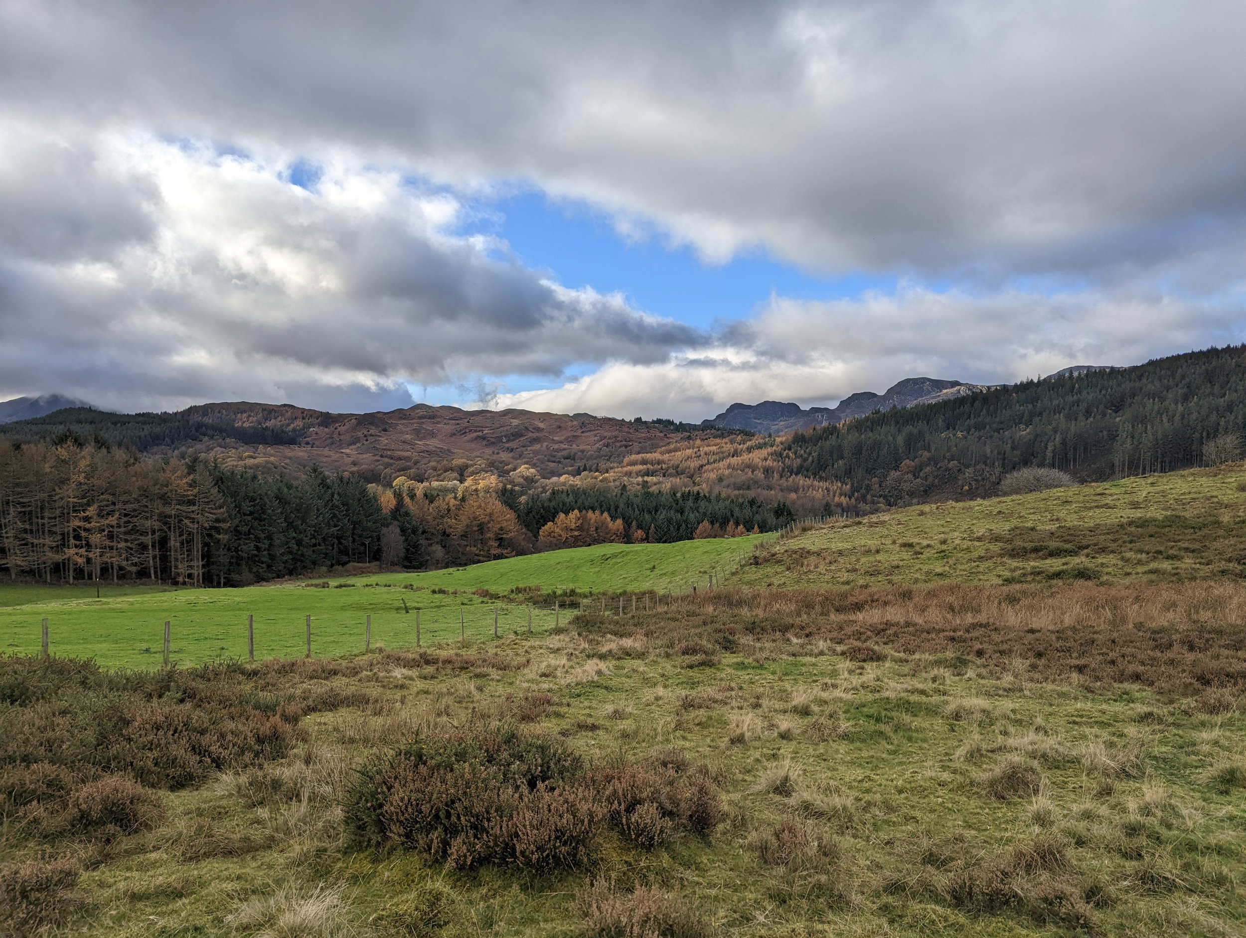
Heading off Penmmaen Bach, the paths were straight forward. We soon picked up a bit of pace on the lower sections, eventually crossing over the very clear North Wales path and instead of following this we headed to our left, up the final peak of Mynydd y Dref, AKA Conwy Mountain.
This one is just as easy to top as the others, but you walk a little further over the rocky hill to get to it. Eventually when near the top, you come across an old fort and a couple of information boards explaining the history of the fort. A little way past these and we hit the top of Conwy Mountain, but we didn’t stop here. We carried on over to get a better view of Conwy and it’s walled town surrounding the stunning castle.
We returned down Conwy Mountain the way we went up it. We retraced our steos until we reached the Nother Wales path again. Here we took the nice wide path all the way back to the car.
It was a few hours out walking and 3 mini peaks taken in, all with good views. An enjoyable shorter walk. It retains a bit of that wild Snowdonia feel as well, surprising considering how close to the sea we were.
Downloads: GPX File | KML File | FIT File | Google Maps File | OS Online route
About Moel Siabod | Parking Location | OS Map | Current Weather
We were staying in the nearby village of Betws y Coed and wanted to hit a mountain peak. Not wanting the crowds and traffic that a day on Snowdon normally produces, we headed towards Capel Curig to take on the wonderful Moel Siabod.
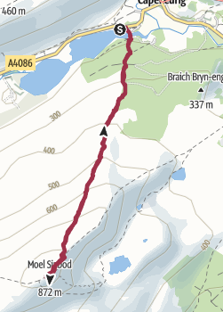
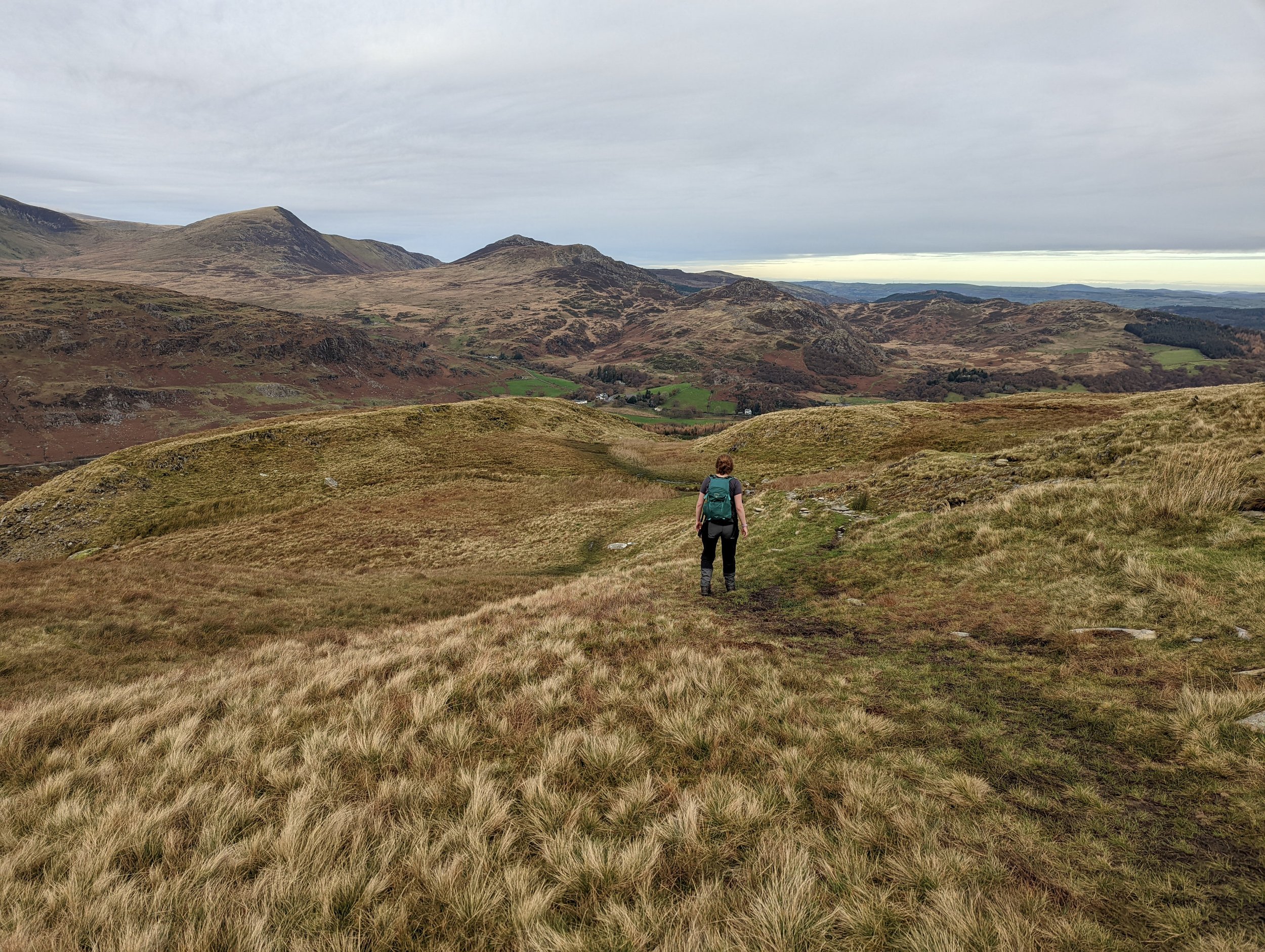
Parking just outside of town, we headed down past Plas Y brenin Outdoor Center and over the small bridge at the bottom of the path. The view up the lake from here gives a fantastic sight of Snowdon, and at the right time of the day is stunning. Moving on from here, we entered the main woodland and headed up through. The paths here are very easy to follow, but they are a little steep so are somewhat energy sapping. We took our time and pressed on through the woodland. There are a few paths off to the side but ignoring these, we headed directly at the mountain.
Upon leaving the woodland, we found that there were some fantastic views that had been hiding away. Looking back towards Crimpiau, as well as over towards Snowdon, you get a taste of exactly what Snowdonia has to offer. From here we continued to follow the path upwards. The direct nature of the path means that you rarely lose sight of it, all the way up towards the summit. It’s rockier, the closer you get to the summit. Due to the previous few days of rain, the rocks had become slippery at points, so we had to take care.

Eventually, we passed a stile and the ground started to flatten off a little more, still direct and aside from a few sections where there had been steps cut into some rocks, it was even easier walking. We managed to keep a good pace until very near the top where the path joins with a secondary path from Pont Cyfyng. At this point, the top is a huge boulder field with little in the way of an obvious path. The route and destination in front were very clear, so we carried on through here being careful where we placed our feet. It’s not dangerous really, but you’re much more likely to roll an ankle here or slip if the ground is wet.
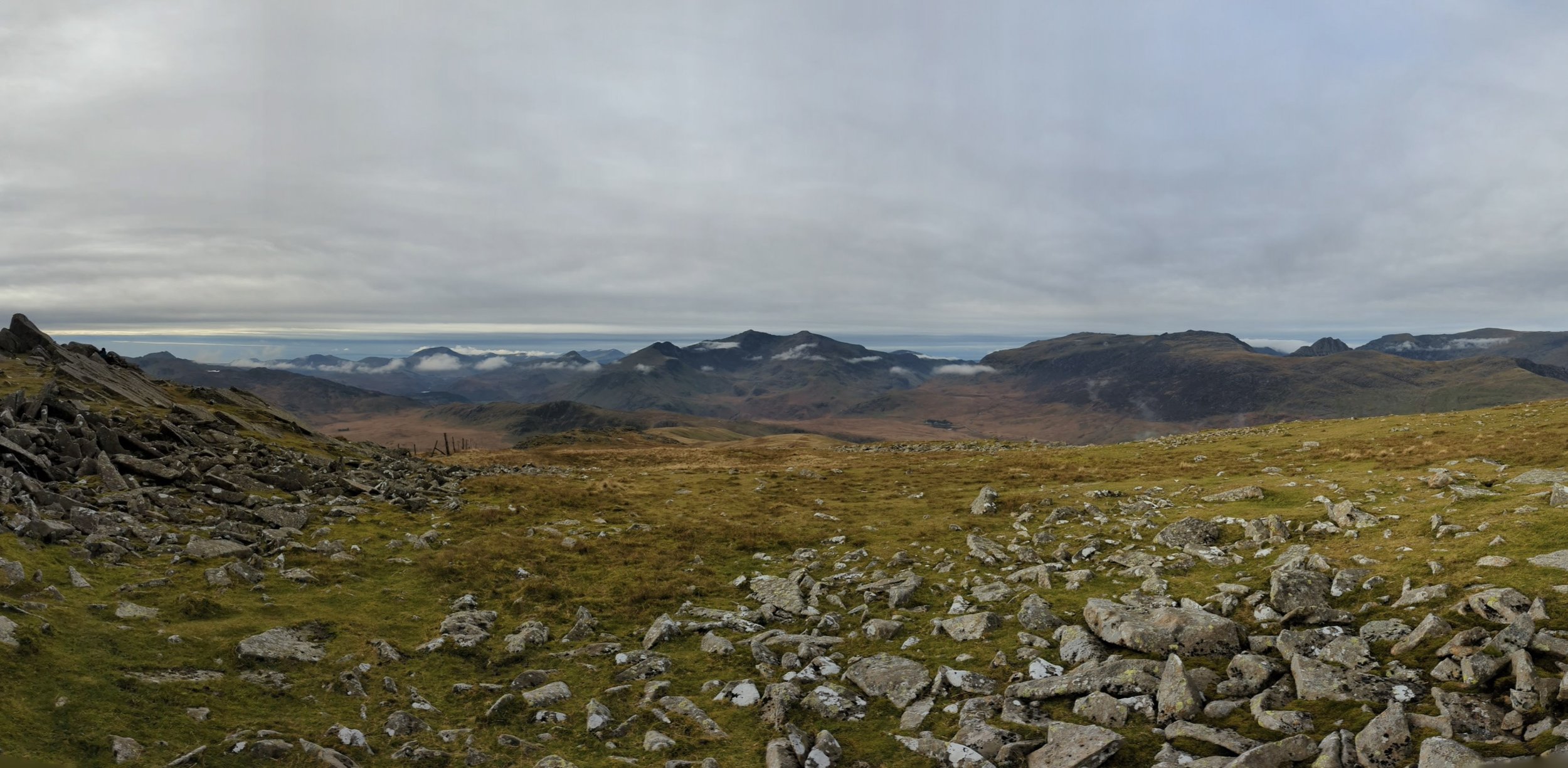
Eventually, we got to the storm shelter just below the peak and then headed to the summit itself. From here you can see 13 of the 14 highest peaks in Wales while standing on the highest peak on the Moelwynion range. Once we had taken in the breathless views across what feels like most of Wales, we moved further down the mountain and sat eating lunch while watching clouds pour over Mt Snowdown in the distance.
Finishing up, we headed back through the boulder field trying to pick up the path again and soon managed to find it. From here, we retraced our steps all the way back down, luckily the views on the way down were just as fantastic with some great mountains opposite. We soon began planning our next day in Wales when we could look to tackle even more of these.
In summary, a great ‘there-are-back-again’ walk. The views on top are wonderful. However, and it is definitely one to do on a clear day, as you can see for miles in almost every direction with little standing in the way.
Downloads: GPX File | KML File | FIT File | Google Maps File | OS Online route
About Gwydyr Forest | About Llyn Geirionydd
Parking Location | OS Map | Current Weather
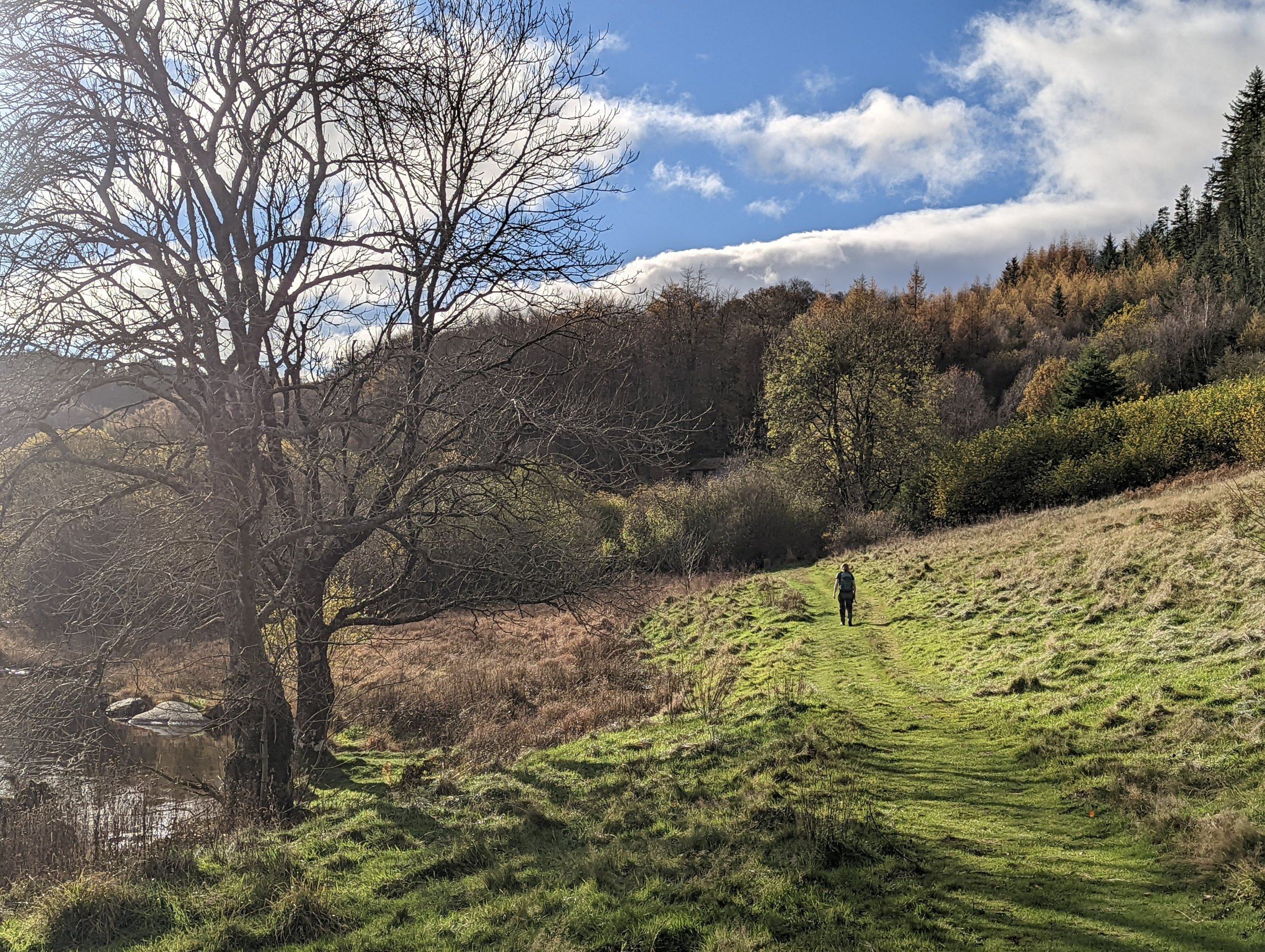
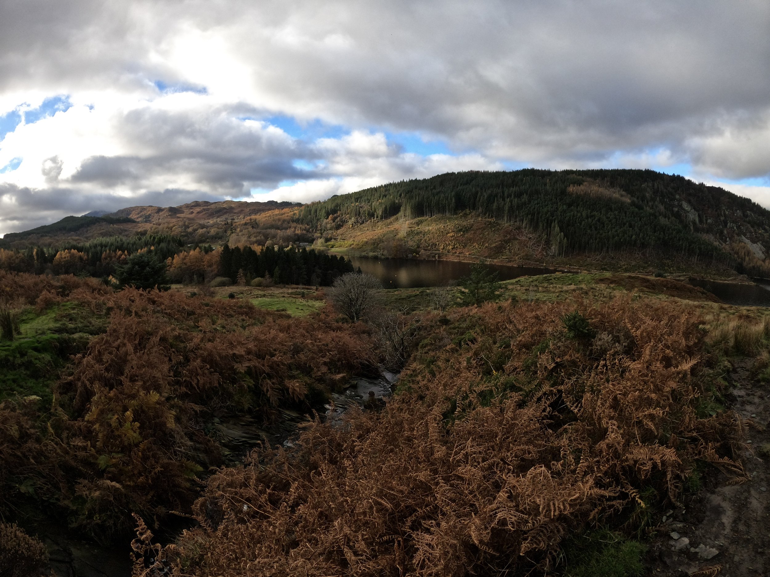
We’ve walked Gwydyr Forest a few times now, and each time we find more beautiful routes, amazing forest paths and stunning lakes. We decided to head further into the northeast of the forest than we have previously explored and found much more of the same. Which is to say, still stunning and definitely worth it.

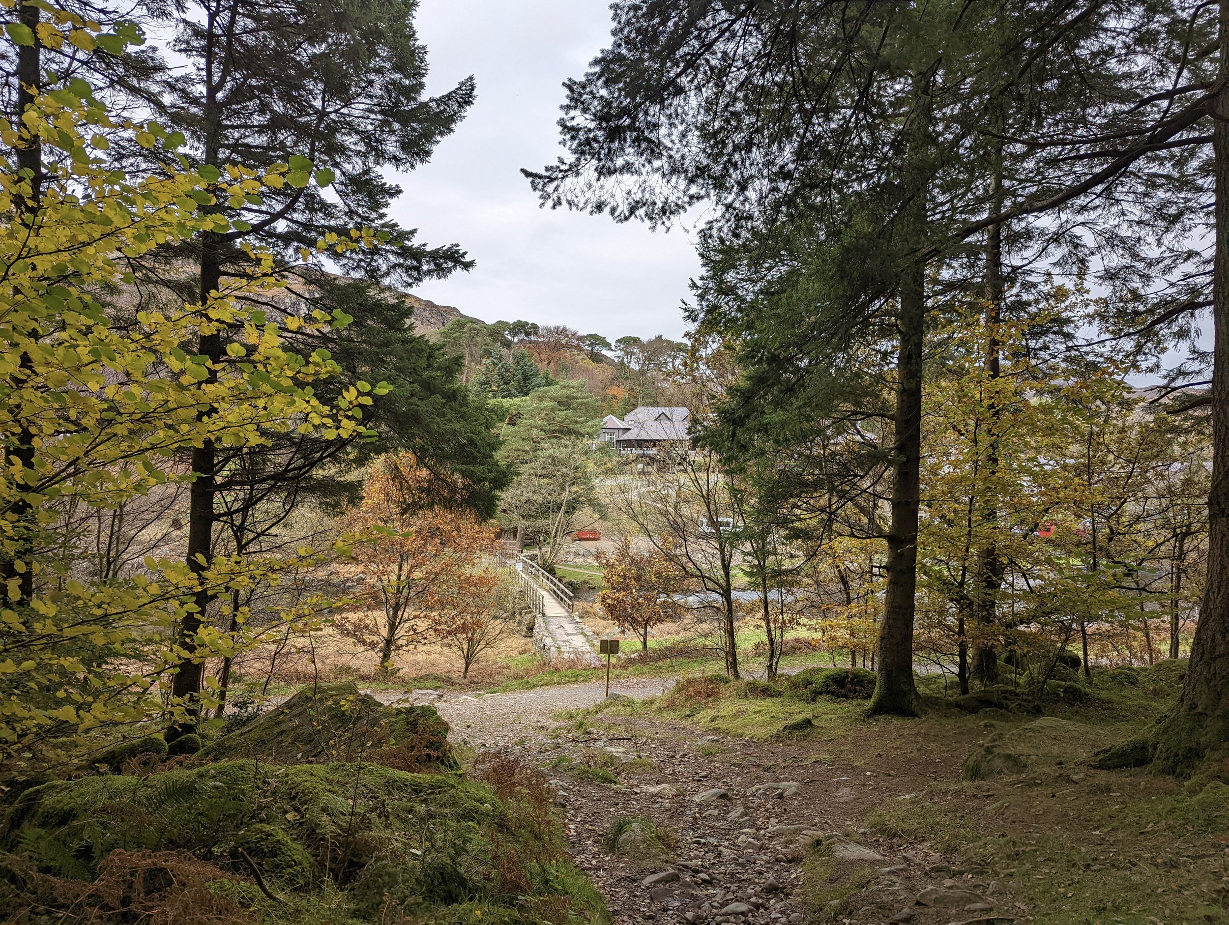
We started in Betws Y Coed and headed up the main road before crossing the popular bridge over the River Lugg. Once here, we joined onto the Snowdonia slate trail path. This runs alongside the river. It is a path at height, on a wooden platform and is unusual as parts of the walkway even fork around trees. Once off the walkway, the path is clear until you come to an open area. Here, a couple of paths go up into the forest but the one we want to follow is slightly hidden behind a rocky outcrop to the left. Once you move behind the rocks, there is a little gate that leads up, over a flat field and runs very close to the river. Leaving the field, we came to a few steps up to another gate where the steps run back down. However, we stay on the paved pathway, still running parallel to the river.
From here we followed the Snowdonia Slate trail along and up to a small forest road, there were a few cars on here so we had to take care but there was enough room for them to pass easily. This a road through the woodland at height and it is easy to make good progress. As we reached the point where the slate trail turns left towards Swallow falls, we continued on the road. It gets much steeper here and the road starts winding up the hill. This took a bit longer to get up and there is a T junction at the end. We turned right here and followed another road along. There are some nice views at this point as the trees behind have dropped away and you get a panoramic view. Further up this road we reach a path.
Upon turning left onto this path, we found it was used as a mountain bike route! We only ran into two bikers, and we stepped off the path in good time to allow them to fly past, but if you are nervous about this, take the left-hand turn at the road you past previous and that would avoid this part. Once we had made it past the bike trail it was onto a nice wide forest walk, and again thanks to the height we got some good views of distant mountains. We followed this path sweeping past our first lake, a small body of water that runs alongside the path for a short while.
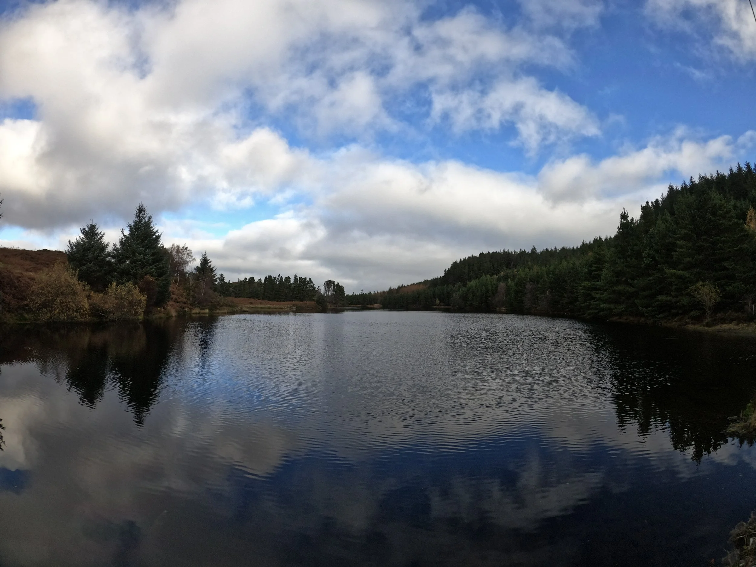
Not much further round and we found ourselves dropping down to a little hidden path to the left. How glad we were that we chose this path, as the next body of water was so beautiful that we decided to sit here and have lunch. While we sat there, we could see a heron across the far side of the lake stalking fish, and upon closer inspection, we saw many small fish right in front of us (I popped the go-pro in to take a look below the surface, so check out the video below).
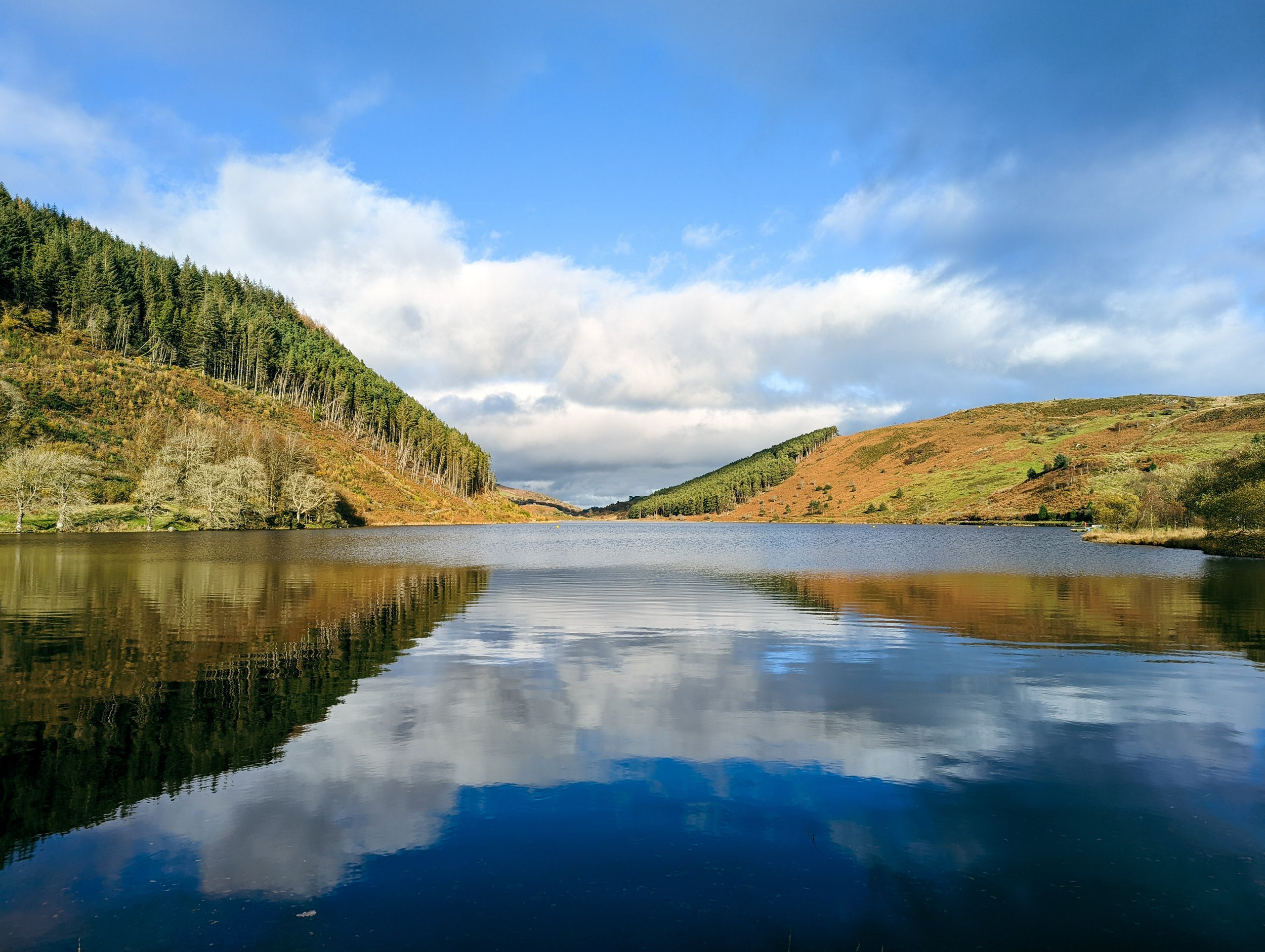
Moving on from here we arrived at a farm, and after some rough navigation found the Sa, Helen path, this one took us over the brow of a hill and gave us the view of the day. Llyn Geirionydd in all its glory on a sunny day. Luckily, we got to follow the path all the way down with this view in front of us. Once at the bottom, we follow a good path to the far end of the lake, before swinging around to the other side. The path here is much rougher and at the section where the hillside slides out towards the lake, we found a small technical scramble, made difficult by some damp roots.
Once over this, the path returns to normal and we soon made our way around the lake with the sun blazing in our eyes. Yes, the sun was surprisingly bright for a mid-November day. Once we had rounded the lake, we headed onto a small road. This leads us back to the lanes we walked to get here. The rest of the route back was following these lanes back down to the slate trail, and then taking that back to Betws Y Coed. We know we have much more exploring to do in this forest, and although a large amount of this walk was on lanes, the view of the lake as we came over the hill was stunning.