Downloads: GPX File | KML File | Google Maps File | OS Online route
About Gey Knotts | About Brandreth | Parking Location | OS Map | Current Weather

Starting from Honistor slate mine (a cheat to some as you’re already halfway up the mountain), we headed directly towards the fell. Photos really don’t show this off, but it is a very steep start. The ground is grassy with dirt path sections, and for a good portion of the start of the walk, we were heading for a point on the map with a bearing in hand instead of following an actual path.
About a fifth of the way up, we came across a more reasonable path to follow and stayed on this for the rest of the route up to the top of Grey Knotts. This path continues through the grassy sections of the hillside and as your height increases, the rockiness starts to set in, a few times the path skirts some bigger boulders but for the most part, stays a grassy dirt path.
Eventually, the path juts into the rocky hilltop and after a few boulders, the path peters away. You make your way through the rocks as you see best. The path resumes the other side of this, and we repeated this about 3 times. Eventually we made our way to Grey knotts. There are some nice views, but nothing that blew us away.
Walking is a straightforward affair across the flatter section between Grey Knotts and Brandreth. You soon find yourself with less and less of a path to follow due to the rocky terrain. It started to feel like a slog and once at the top, it felt like we were just standing in a rock field with a very pitiful view. Although we found better views coming down, which somewhat made up for the disappointment of the summit. We aimed to head down the northern path from Brandreth, but as you’ll see on our map, we found it fenced off and rather than climbing over the fence where no stile was present, we decided to head down the west face.

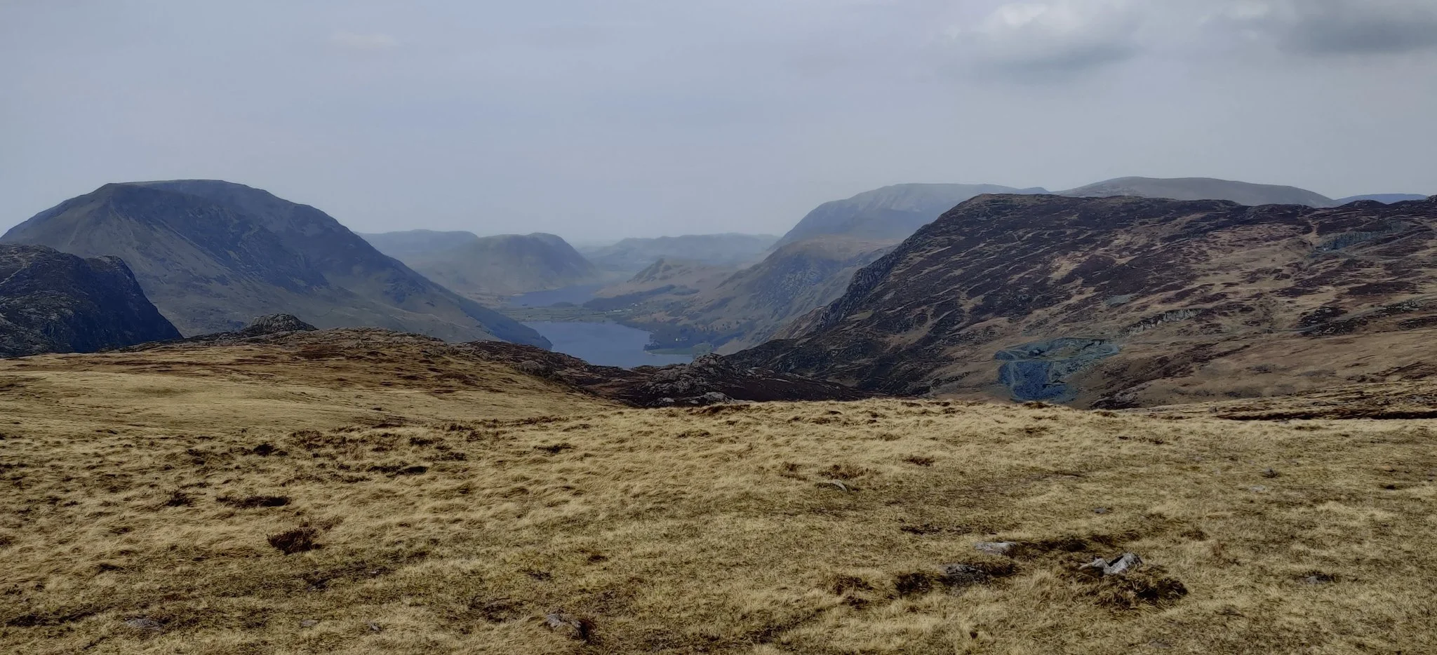
This was the first of the more impressive views that came during the second half of this walk. We passed parallel with the beautiful and Great Gable, this aspect gave it a formidable and intimidating feel. It was fantastic and you really get to see the awesome dome of the mountain. The path swings around, again over very rocky paths and eventually comes to a stile over the same fence as we wanted to pass earlier. From here, we follow the obvious path back towards Honistor. This path dissects the northern path down from Brandreth, so if you do manage to find it, you can follow this part of the route easily. It’s a well-trodden, but still very rocky path, and although the view in front is a little flat, the view to the left down into the Buttermere Valley is sublime. You can pick out the ridges from Haystacks all the way along, as well as getting a great vantage point of the lakes of Buttermere and Crummock Water.
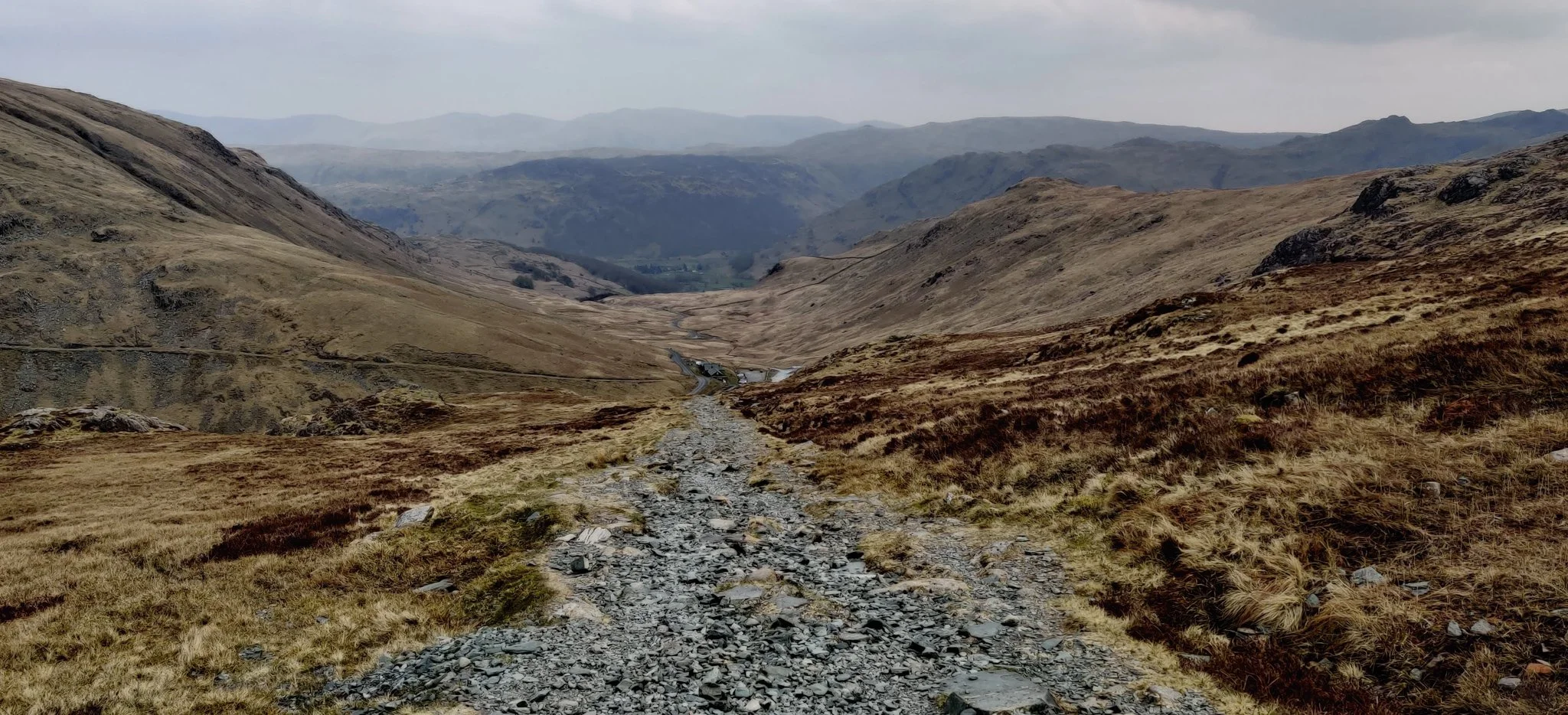
Eventually the path joins up with the main miner's route from Honistor. This is a perfectly straight track between the Honister mine and Dubs hut, and although it has a few loose rocks, it’s very easy to walk on. You feel like you are looming down over Honister Slate Mine and right at the end of this section, the path follows a couple of switchbacks to get you down without the direct steepness of the start. At peak times, the Slate Mine is a hive of activity with walkers and adventurers taking on what the slate mines have to offer.
It’s a great route to see some impressive views of Great Gable and down into Buttermere. But, the rocky sections of path and uneven terrain made it pretty hard going and, honestly, a little bit boring. Especially for the amount of effort that gets put in at the start. For that reason, it isn’t a walk we will run back to, although we will always remember the views.