Downloads: GPX File | KML File | Google Maps File | OS Online route
About Raven Crag | Parking Location | OS Map | Current Weather
We awoke on a very damp, cloudy day. Rather than head to the high tops and likely not get any view, we decided to tackle Raven Crag. This was a Wainwright that we hadn’t been able to do for a couple of years, due to wildfire damage on the fell.

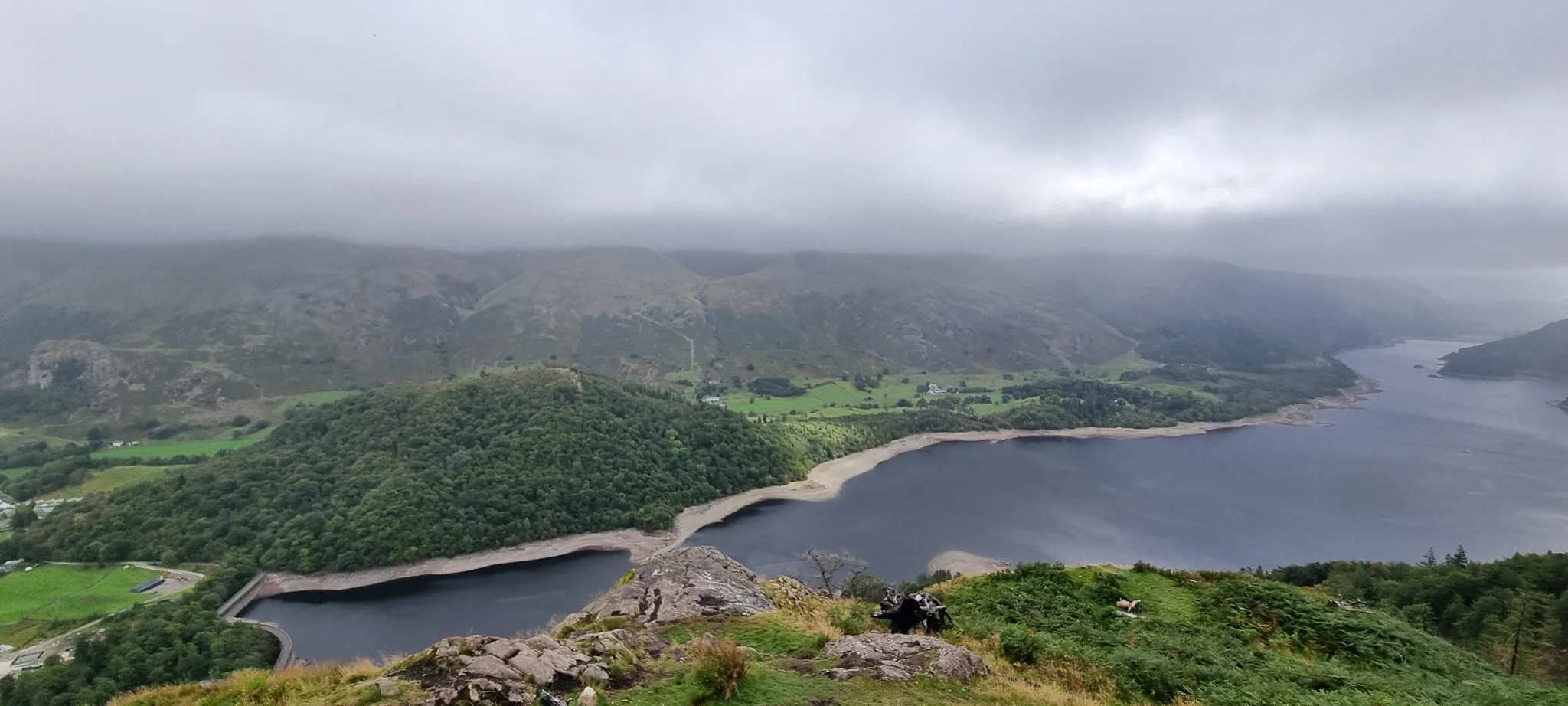
We headed off along Dam Road, passing a small campground. About a third of the way along, barriers had been put up to stop cars from continuing along the road. This ensured we didn’t need to be on car patrol and were able to walk here with a little more pace. Soon we arrived at the dam and were treated to an impressive view down along Thirlmere. We didn’t get too many peaks showing due to the clouds, but we could see most of the way down the lake.
At the end of the road, with the car park opposite, we followed the fork to the right and joined the fellside path. There were a few ways up and we settled on the direct route, taking it steady. The other paths are much easier than our route, but much slower. Our route wasImostly a rocky track with a few sections with loose rock. It never became too difficult, but the angle at times was quite steep. Passing a crossroad where the steady path heads to the right we joined a dirt path.
This path was a bit harder than the previous one. It wasn’t too wide, so we had to take our time, but after 50ft or so, the path aimed back in towards the hills and was much easier to finish. We came to a crossroad, after taking the left through a wooden gate we were now on the main path to the peak. It’s a much easier dirt path with a few sections of wooden steps and walkways. This bit snakes through the woodland at the top of Raven Crag. It’s quite an odd feeling ticking off a Wainwright while still under the tree line.

Once at the top, the views are incredible, spectacular in fact. I’m not sure if it was the moody day, or that the platform is just an amazing viewing point, I realise now how such a small peak could become a Wainwright, now I understood. It’s just amazing.
We followed the same path down that we had taken to the peak. Upon reaching the crossroad (and having seen Castle Crag Fort listed on the map), we set out on a little hunt. After a couple of minutes of walking we realised this wasn’t the right path, so headed back to the crossroads where we took the path opposite Raven Crag. It’s a little hidden which is why we missed it, and was quite overgrown, but once on the path it became easier to follow.
Once at Castle Crag Fort, a historic fort location, you can climb up a rock to the summit. This is where I assume the fort reached. There is nothing remaining of this, however. We took a look around on the viewpoint and as the clouds continued to close in, we headed back off towards the crossroad.
Once here, we took the left path (the only one we hadn’t taken at this point!). This is a nice way off the fell. It is easy going and if you wanted a steady way up the fell, this is probably the way to go. Being a forest track, it’s wide and compacted and thanks to the tree cover, it did keep most of the rain off us both. As you make your way down towards the valley bottom, you get a good view across to High Rigg before descending to road level.
Once at the road, we followed it back to Dam Road and then followed Dam Road back to the car. It wasn’t the biggest or longest walk, but it did reveal one of the best views we’ve seen in the lakes. The moody day really added to the atmosphere and it’s not a bad walk if the weather has turned against you.