Downloads: GPX File | KML File | FIT File | Google Maps File | OS Online route
About Hadrians Wall | About Greenlee Lough | Parking Location | OS Map | Current Weather
Having previously walked a short section of Hadrian's wall, we decided we wanted to do a much bigger section on our way to Northumberland. We parked at Cawfields, and aimed to get to Sycamore Gap as roughly our half-way point.

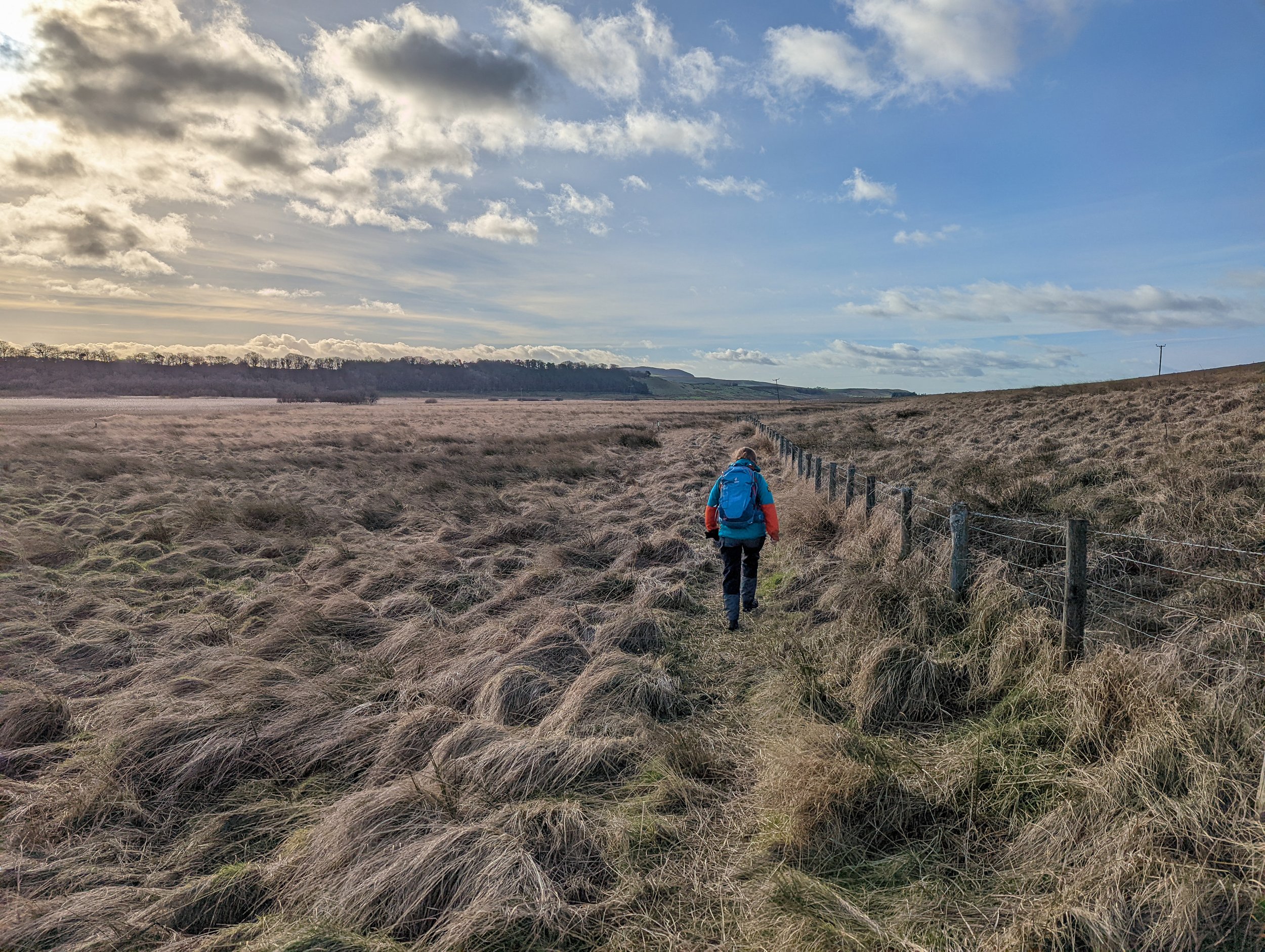
Setting out past the quarry, we very quickly picked up the wall. It is not THAT tall, but it’s also obvious and we took the higher path which hugs the wall rather than the military way. The path is uneven, and a mix of dirt, rock, and grass, but not difficult and we managed to get a good pace. Once we crossed the next road, we again took the higher path which keeps the wall close.
We had read so much before and during our stay that it was incredible thinking of the size it used to be, the landscape it towered over and how bleak the winters here might have been. As we carried on alongside the wall, stumbling across small tower sections, we slowly picked away at the height and more of the view kept building. From the wall, we could see for miles, both north and south. It is understandable why they would have built the wall here. This part is a long stretch of unbroken wall, and although it does not have the height it once did, the sense of what a barrier it must have been does not leave you.
The path is still very uneven, and still a mix of rock, grass, and dirt at different points, but it wasn’t hard to walk on and we were soon crossing another road. This next stretch would prove to be the busiest, there was a lot of people here. Yes, we were approaching Sycamore Gap so I assume it was the amazing photo opportunity that they had come for!

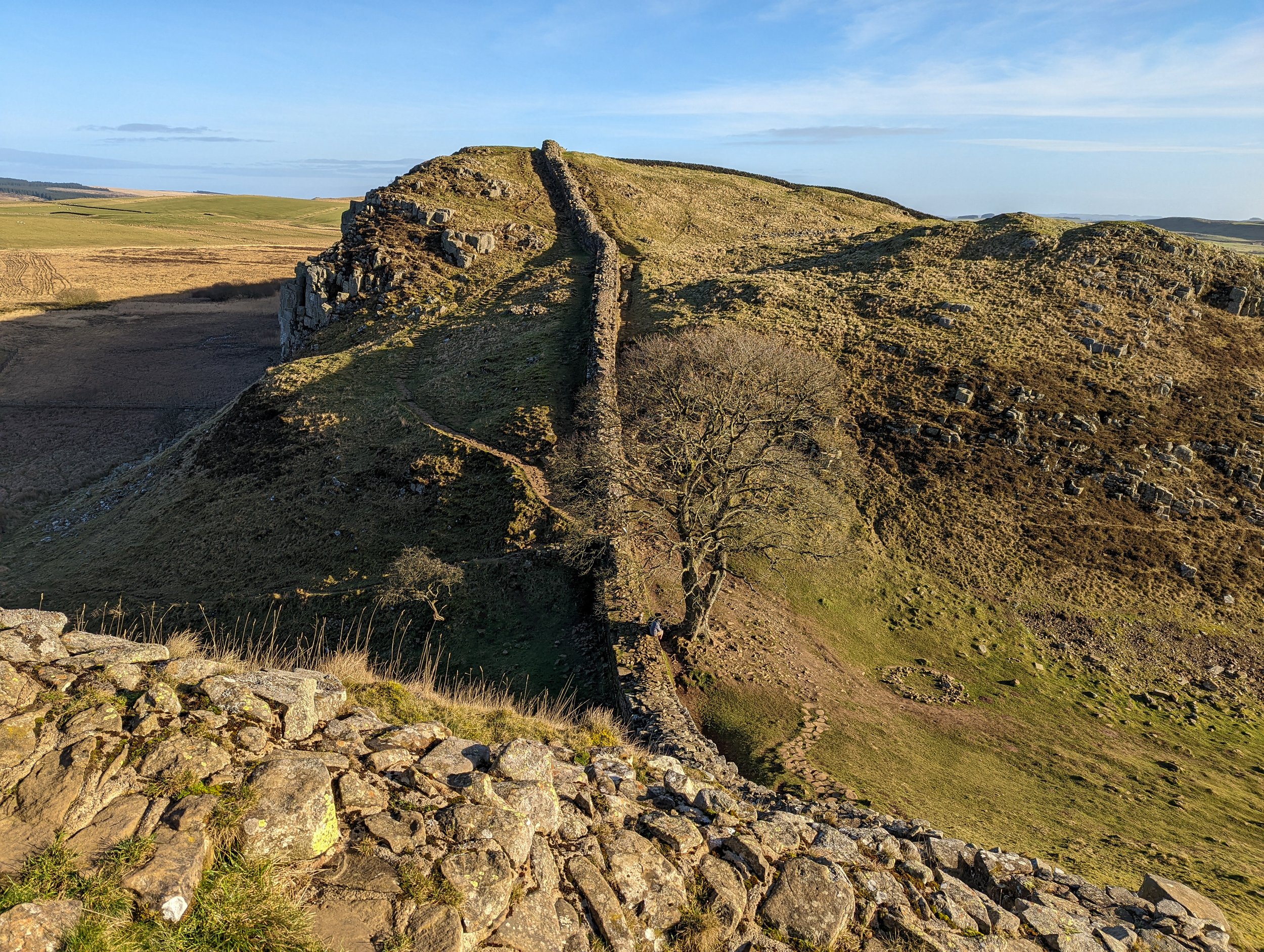
The path sweeps down below a huge crag that really didn’t need a wall to block the way, it is huge! And once at the foot of the crag, there is a steep section of steps which lead up to the top. Once on top however, it’s flat and we continued to follow the wall along. We got to a small, stepped section, which lowers you down to Castle Nick, the ruins of an old fortification, we had a look around before continuing the Hadrian's wall path and this is when we made it to Sycamore Gap.
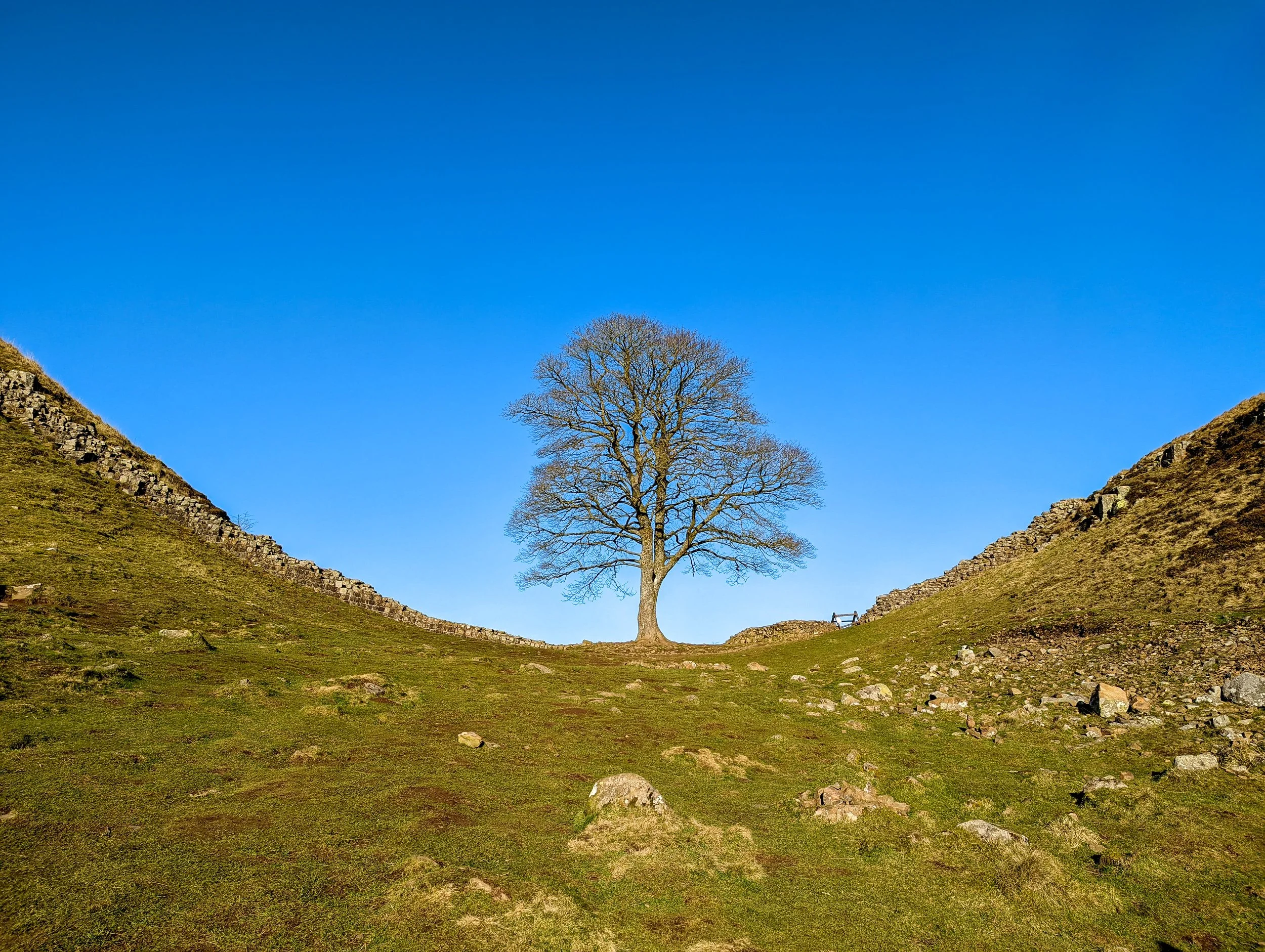
You have most likely seen it a thousand times, and if not, at least once at the start of this webpage! But it is one of the most beautiful points on the wall. The wall gracefully drops down from the crags and meets in the middle where an old, lone Sycamore tree grows. It creates an amazing border and with a clear, or starry sky, the view is amazing. Again, this is the spot where we saw the most people, and for good reason.
We decided to take the lower Military way path from here as it looked a bit steadier and were able to bypass the crowds of slow-moving visitors. We followed the wide grassy path on a steady climb over the next crag which runs parallel to Crag Lough, however you cannot see it on the lower path.
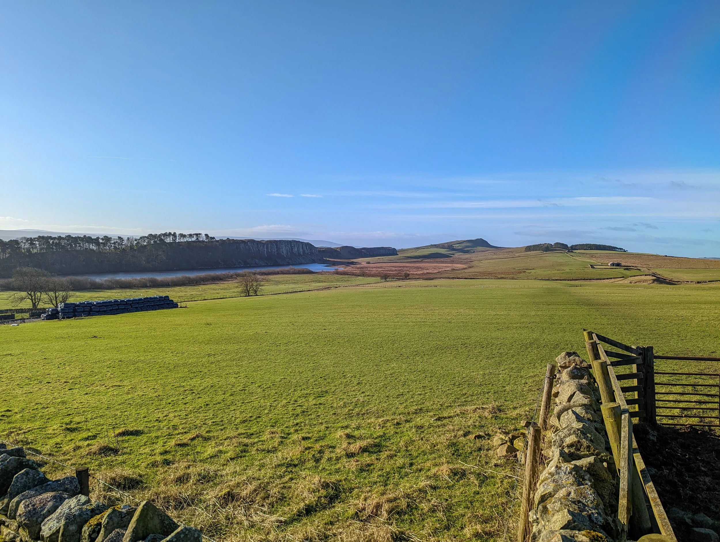
Coming off the crag, we headed to Milecastle 38, and it is at this point we left the main Hadrian's wall path so we could turn this into a looped and more varied route. We followed another grassy path in the shadow of hotbank crags, which the wall runs over. Eventually, through these fields, we met up with the Pennine Way and followed it to the left. It follows a winding path down through some fields and through a slightly boggy section by a river. Once out the field we had originally planned to come off the Pennine Way and go past Greenlee Lough. However, although the maps looked like you could go this way, and that there were multiple paths to here, there was also a sign advising it was private property and there was no public footpath. Because of this, we made the decision to extend the walk by quite a way and follow the path around Greenlee Lough.
Staying on the Pennine way and carrying on over to the far side of the lake, we took a path and left the Pennie Way here to wind off to the North. This clear path runs us alongside and around to the other side of the lake. At this part of the route, you are walking at a higher elevation, and you get a fantastic view out over the lake towards the crags that the wall hugs. Eventually, the path works its way down towards the lakeside. Now this is where the path comes alive!
Boardwalks have been put in to protect the walker from the marshy inbetweeness of lake and land. Following this aging, bleached boardwalk, we were swept through head high reed beds. With the golden, afternoon sunlight diffusing though the pale reeds, everything we were seeing seemed to transition to nothing but a warm gold and silver greyscale. Colour and sound fading out until all we saw was the forest of tall whispering, waving stalks giving some warm contrast to the cool silver cloudy sky above. They shushed us as we walked through. Filtering out all external noise, we felt solitary and peaceful. Beautiful. One of the best parts of the walk. It was an unexpected environment to walk through and it made us glad we had come around to this side of the lake.
That feeling soon slipped away. When we came out, there was a second boardwalk to the left which is where we were clearly heading on the path. However, this was closed due to storm damage. We had already extended the walk once, and this was making it even longer (not normally a major issue for us but we also had a long drive afterwards, so it didn’t put us in the best mood).
We followed the alternative path above where we had planned, there was a tricky section with no obvious path, so we made our way up as the map showed and once out, we reached the next path. This was closer to a farmer's track. Much easier to get some pace and we had already put the diversion behind us. We followed this along all the way to the farm where we passed a couple of horses that came to us for a scratch and a stroke.
Moving away from the farm, the track was steady and after a long winding climb, we came to the main road. It was incredibly quiet and had space at the side of the road when cars did pass, but only two passed us. Obviously, the pace was much easier, and we could pick out parts of Hadrian's wall to our left. At the end of this road, we turned left. This road dissects between the wall, so was a little busier, but we were only on in for minutes and, again, there was room at the side if there was a car passing.
We climbed to the top of this road, and that got us back to Hadrian's wall, and onto the military way. We followed the way along back to Cawfields and the carpark.
We absolutely loved parts of this walk, Hadrian's wall was interesting, Sycamore Gap was stunning, and the silver walk through the reeds was beautiful. It ended up being a bigger walk than expected, but on a hot and sunny day it was good walking.