Downloads: GPX File | KML File | Google Maps File | OS Online route
About Causey Pike | About Scar Craggs | About Sail | About Outerside | About Barrow
Parking Location | OS Map | Current Weather
This is a very difficult route, please read through for more information before attempting.
We spent a lot of time researching this one, we had seen Sail several times and wanted to do it as part of a big loop and there were quite a few options to do this. Our biggest concern was around Causey pike and the best way to attempt it. We read a lot online and it was quite inconclusive (due to different abilities etc) so we decided to head out on our loop with the idea that we will turn back if it becomes too difficult.
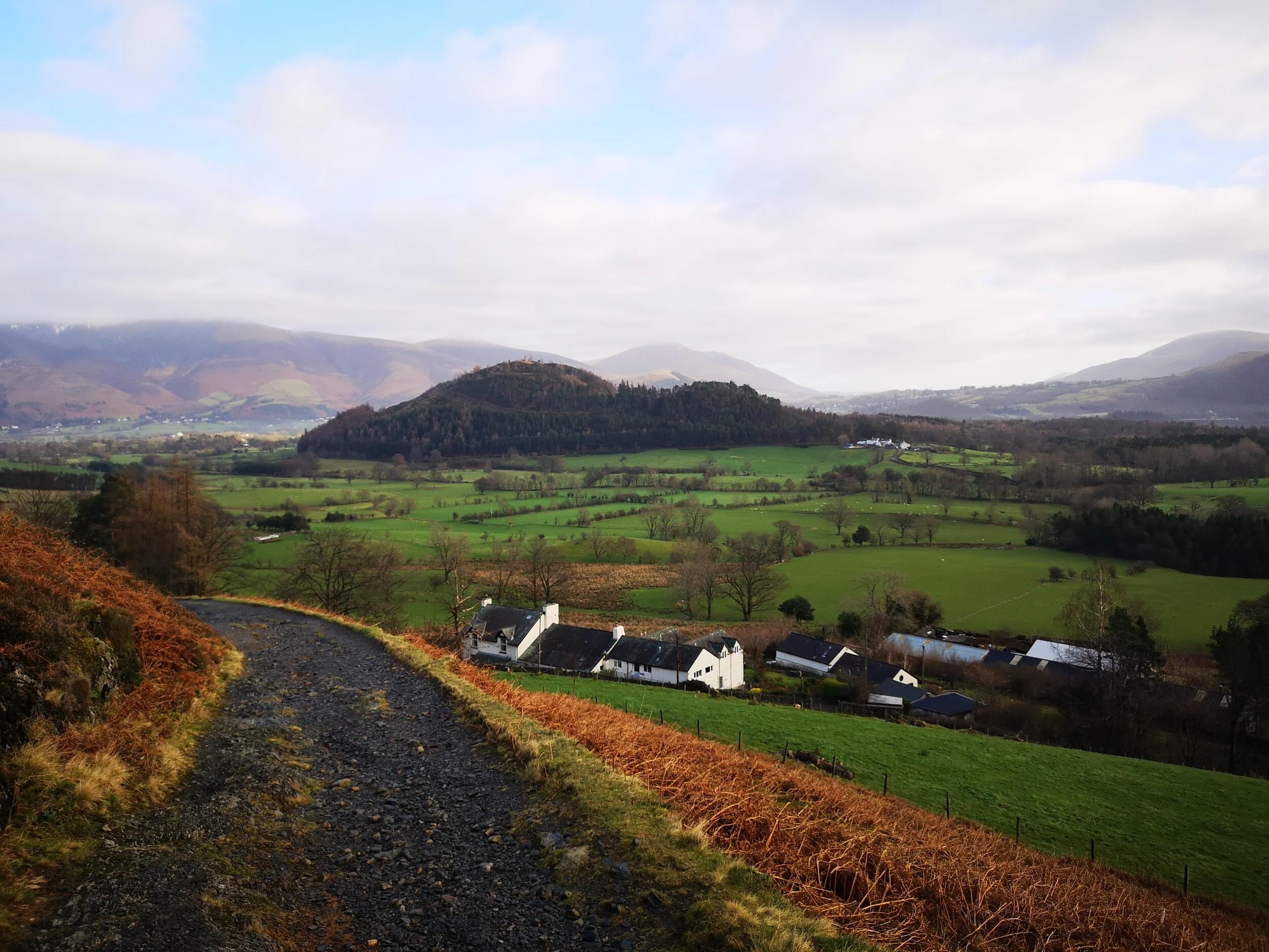
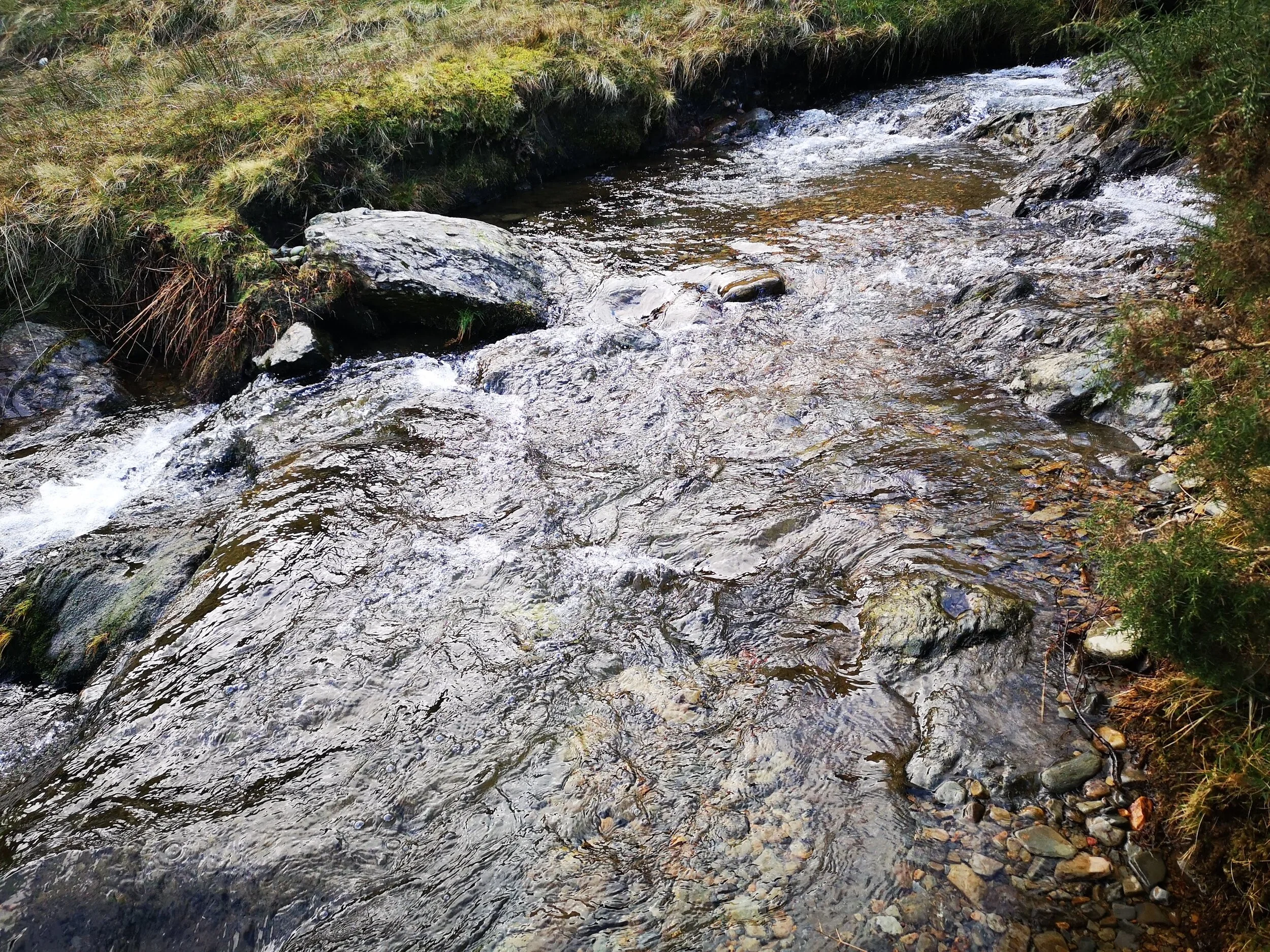
Parking at the bottom of Causey Pike we headed up the main path and split right, ensuring we head up the valley towards Causey Pike direct, rather than the other route to the left which goes over Rowling End and Sleet Hause. Not far up the path there is a route to the left over the river, we had a look around and decided it wasn’t too easy to cross here so went back to the main path and carried on up, the rocky path is very easy going and the views up the Valley are really great. After a short while, there is another path to the left to cross the river, this one was much easier, so we hopped over the stones and started the main climb.
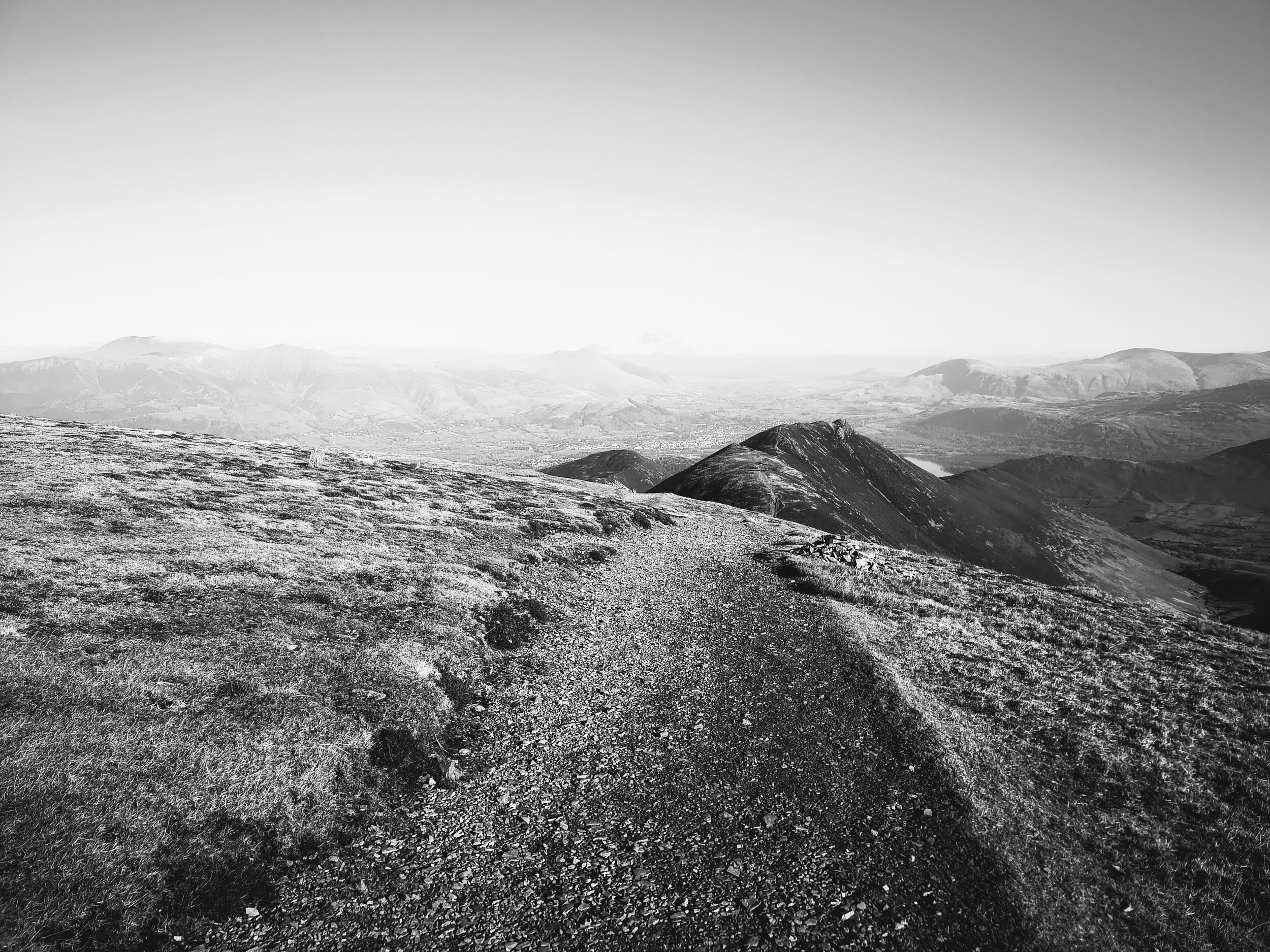
The steepness of the path doesn’t vary much and once you have claimed a short while you get views out towards Derwent. The beautiful sunny day we had was the perfect weather to be out in the lakes and looking over the mountains and lakes makes it all the better. The path from here turns back on itself and heads directly up to causey pike, it gets a little steeper and we had to have many water breaks due to the heat but taking our time we made good progress. The rocky ground does have some small sections of scree which became a little harder to navigate over, but most walkers won’t be troubled.
Upon reaching the crossroad where the path from Sleet Hause meets the one we were on, the area flattened with a lot of heather and wildlife around. From here, the climb to Causey Pike gets much steeper, the time it took to get to the base of the rocky top was similar to the whole previous section of the walk, but again taking your time there isn’t too much here to stop most walkers and it was more about managing our water more than anything.
Once at the top tier of Causey Pike however things are much different, from below it doesn’t look too difficult, but photos don’t do justice to the size of the rocky formation you need to make you way over. Again, we had read a lot so knew what to look out for but even prepared as we were, it became very difficult. Once at the main rocky section, there are two options, follow the path to the left all the way around, or moving along this same path for a few meters and then scrambling up the rocks. Initially, we thought taking the path all the way around would work best, however after seeing the very precarious path we decided it was too dangerous and thought heading into the rocks was a much safer route. This turned out to be true, but there is no doubt in my mind that this pushed between scrambling and climbing, and doing so on top of a mountain when we are walkers first and foremost isn’t our most favourite of things. It required a lot of time and effort to make sure we used a safe route up, ensured that we could stop and help each other and that we were as safe as possible. The actual height you need to climb isn’t too far at all, but doing so at such height felt so precarious as we knew one wrong move could genuinely be fatal. Eventually, we got to the top, but both agreed that we would not want to do that again, and I would advise anyone who has any worries about this to avoid this route up completely, instead taking a path to scar crags and walking along to top to here.
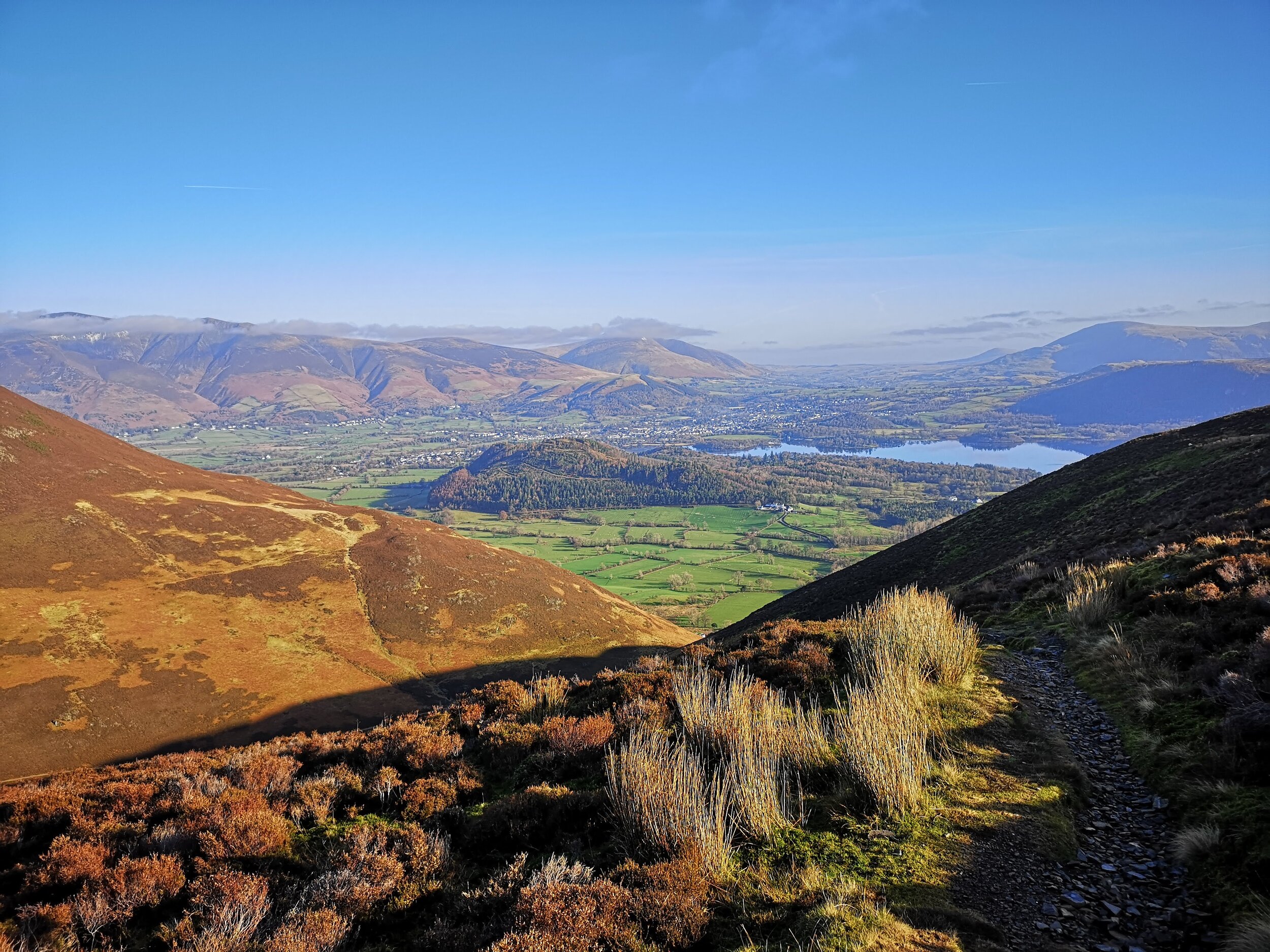
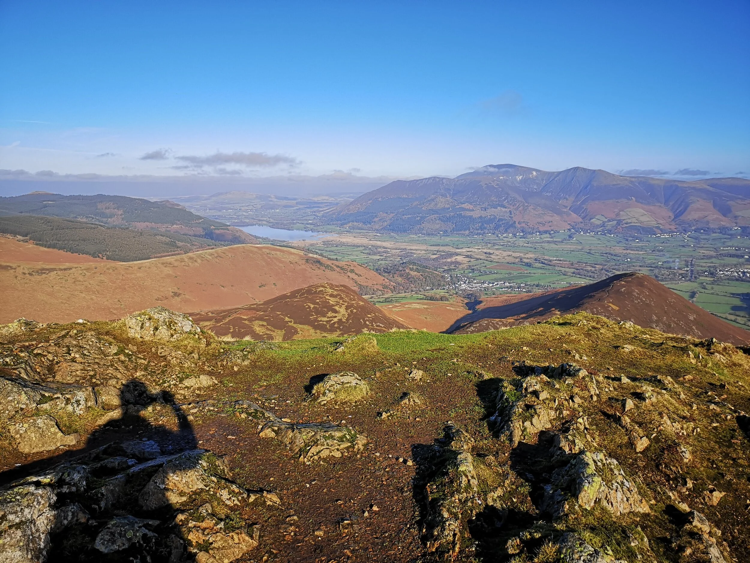
The views on top are stunning, however, we felt quite drained from the climb and wanted to get moving on better ground. Luckily, that comes in droves with Scar Craggs, it’s a nice wide ridge walk with little height to gain and views directly at Sails Zig Zag path right ahead. Although it was a very warm February day there was snow in some of the sections of the path on sail really highlighting the path. Once over Scar Craggs, it’s a short walk down to a crossroads at the base of Sail, the path to directly in front taking you up Sail, so this is the route we took.

This path has some mixed feelings for a lot of walkers, the zig-zag path which is now in place on the fell is very unique and really makes it stand out, it’s also much easier to walk up and most importantly, as part of the fix the fells campaign, it ensures this mountain is kept as erosion free as possible. Some people prefer the old direct up route, which from a distance you can see the scars from, they feel the new path is an eyesore however for me it’s a great way up the mountain and helps to keep fell walking as sustainable as possible. Walking up this, is easy enough, it’s like an alpine switchback road and in some ways, it’s really nice as the view keeps changing, but it does get a little mind-numbing towards the top, you just want to get to that peak! Once on top, however, the views are wonderful. We had some food hear and took in the views, there are so many mountains and valleys on show, it’s one of my favourite viewpoints.
With three Fells down, we had two left before getting back to the car, luckily these are much smaller, so we headed down off Sail back down the zig-zag path until we got to the crossroad again. From here, turning left takes you down a sweeping path which is the same path we started on. This path is very narrow and if you’re uncomfortable with steep ledges or heights it might give you some worry. It’s also quite loose underfoot which doesn’t help things. We took it very slow down here and eventually when getting to the bottom where it flattens out managed to start walking at our normal pace again.
Once down on this level, there is a grassy path leading left towards Outerside, taking this is a little boggy but we managed to keep dry feet. Once at the base of Outerside it’s a very simple fell, there is an obvious route up and over with heather keeping you on track either side of the path. Once on top, it’s very easy to want to get down and go for Barrow to complete the 5 fells, but we took some time here to make sure we got all the views, from here you can map the walk from Causey pike all the way to Sail and seeing the height you have come from is quite a sight, it’s rare we do a walk that gives such a view back of the fells you just completed.
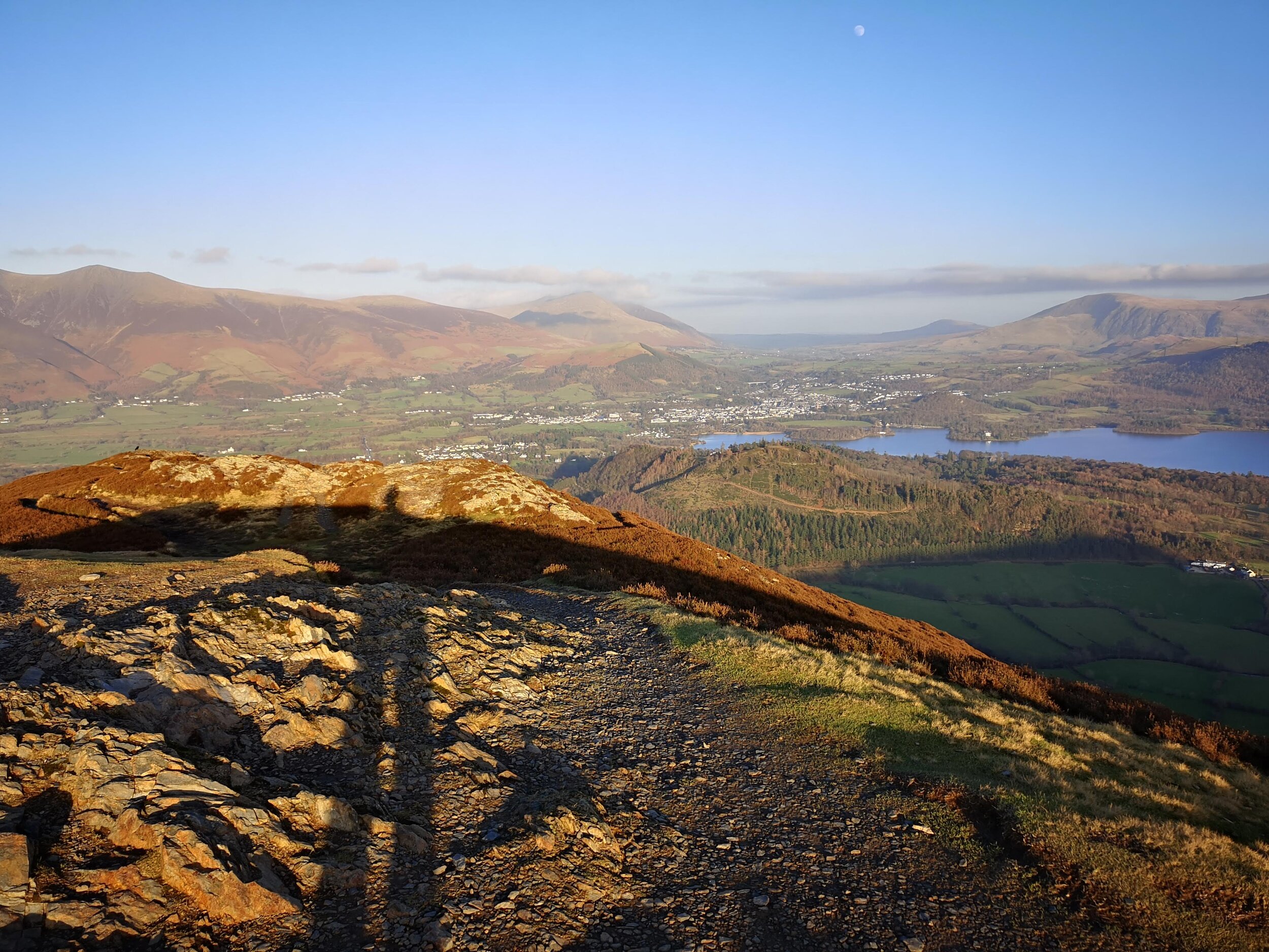
Heading down from Outerside is just as easy as going up, but once you’re off the fell the paths start to go several ways and are easily lost in the heather. After keeping our eye out, we did manage to get through the main Barrow path and from here we made our way to the last peak of the day. Getting to Barrow from here again is easy, a single path takes you to the peak and the climb is simple enough, there is a spell where it is a little rocky but nothing to worry about, getting to the top opens up that final view back towards Derwent Water and Keswick and is just as nice in the evening light as it was when we started walking and looked back from Causey Pike. The route down from Barrow is very different, it’s grassy all over with some sheep occupying the ground around the path, which does go a few different ways but links back up again, it almost feels like the decline is always at the same angle so it does strain, especially after the 6 hours of walking we had been doing. Towards the bottom, we were feeling it, but it was never too much to stop us. Right near the bottom, there is a path crossing the one we were on, taking this right takes you past a small woodland area, which helped shade us from the sun that was still beating down on us and moving along this section is very easy, it’s a simple path that undulates now and then but for the most part is flat. Eventually, you come out onto the road where we parked, there is plenty of room for cars to pass if they do come down the road, but only two passed us the whole time we walked it. Eventually, back to the car we sat down and looked at the fantastic, if not very difficult loop we had just finished.
It was a great route, people who love scrambling or climbing and have a head for heights, go do it right now. If you’re unsure or don’t particularly like scrambling and the risks, this route isn’t for you. I would suggest heading up the middle of the valley towards Sail and cutting across Scar Scragg's to take in Causey pike from a much easier direction.