Downloads: GPX File | KML file | Google Maps File | OS Online route
About Blencathra | About Mugrisdale Common | About Bannerdale Crags
This saddleback shaped mountain has commanded our attention and intrigue every time we drive past it on the road to the Northern Lakes.
Having no head for heights whatsoever. Dan managed to find a walk which would not only avoid sharp edge, but would not make me feel like a nauseous jitterbug the whole way around.

We parked at Scales, on a small carpark to the right of the White Horse Inn. We began by walking up the road on the right to Mousthwaite Comb then took a footpath to the left, before Comb Beck. We ascended quickly on a narrow stone path, thick with vegetation either side, until we reached a plateau. From here, four or five footpaths trailed away in different directions. We chose the left most footpath, then kept left up onto Scales fell when it forked. We believed the right fork ran straight to Sharp Edge. But as we progressed up onto the grassy fell, we soon realised- with our heightened viewpoint- that the right path was also the way to the gleamingly beautiful Scales Tarn. We were treated to a view of it from above as we walked on towards Hallsfell Top. Its colour was a cerulean blue from the clear sky and had Sharp Edge as its backdrop. Interestingly, a path could be distinguished from the tarn back up to our route. Next time we do this walk, we will most certainly pay this tarn a visit!
After having a funny turn whilst watching a someone climb up one of the ridges, possibly Hall’s Fell Ridge. (Yes, not only am I scared of sheer drops, but also scared in sympathy for other people who put themselves in this position!) We got to Hallsfell Top. An unassuming, plain ring trig marked it. Instead of carrying on over the Saddleback, we turned and made our way across to Atkinson Pike, rambling past the white quartz stones arranged into a cross. We then half walked, half slid down the blue screes and onto Mungrisdale Common.
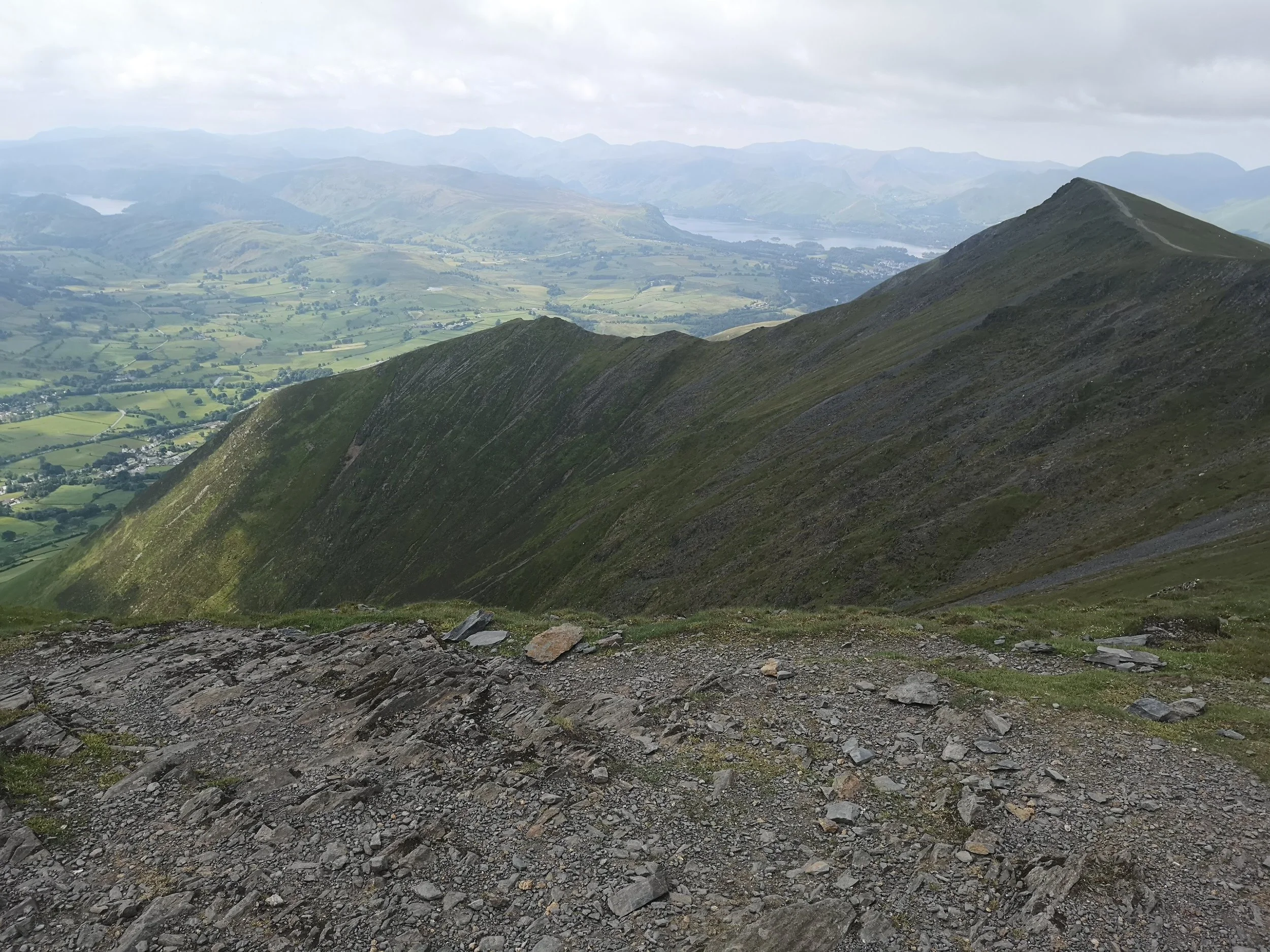
The moment we descended onto the common, the walk was transformed. Regardless of being one of Wainwright’s least favourite, it must be one of my most loved. Dan had to put up with my ‘hills are alive with the sound of music’ pose most of the way. We were lucky to do this section of the route after a few baking hot days. The normally marshy terrain was springy and comfortable under foot. Small cotton flowers smothered the grassy plain, bending happily in the breeze sweeping through. Beyond us, to the left was Skiddaw, with a clear view of Skiddaw house. Derwent water was framed betwixt the mountains. Behind us was Blencathra. To the east lay Bannerdale, this was yet to come. We stayed and ate our lunch here perched on the cairn. We then veered right, along an untrodden grass path, skirting a bog or two. GPS and compass are best used to get off this common correctly.
For the last leg. We made a triangle out of Bannerdale crags, as you can see from the map above. Travelling along the crag itself was a very rewarding experience. We were met with views of Mungrisdale and saw Great and Little Mell Fell in the not-too-distance. Our way back was a gradual descent via another narrow path along the side of the valley, over a bridge, then a short ascent back to the first plateau. How mountain bikers manage to stay on these trails, I’ll never know! From here, the way back was the same as the up. Sped up somewhat because we were being followed by a very dark cloud threating to empty its contents. Luckily, we felt the first spots of rain as we had the Inn in our sights. All in all, a very rewarding and rejuvenating walk.